cycling

Three Fields

11/03/17

I don’t know what was wrong with me last time, as I found this – dare I say it – easy.  A pleasant enough ride if a little uninteresting.  The only section I was familiar with was Clumber Park, but in the opposite direction this time.  The day was very mild and after the first stage I didn’t wear my windproof, and even at the start I had changed into thin gloves.  The sun tried to come through the cloud with limited success.

I had brown rice the night before, then tea and a croissant on the train.  First control at 44 km was at a village hall with local ladies (very stereotypically the only males in sight were the riders and orgs) providing tea/coffee and cakes.  Nice but not cheap, I understand the proceeds go to a local church fund so it’s better than tax-avoidant Starbucks which furnished me with breakfast.  Shortly after leaving the control I passed a couple of riders sitting on the verge, next to a pick-up with trailer facing in the wrong direction and two inhabitants.  It didn’t look as if I could be of any assistance so I kept on going.  I’ve since read on yacf that there were actually four riders, knocked off when a 4 x 4 towing a trailer overtook and came back in too quickly.  The driver didn’t stop, one of those involved said they might not have even realised what had happened (it was a large trailer).  The vehicle I saw was passing and the two guys in it sounded very helpful.  The worst casualty had two cracked ribs.

On leaving Clumber Park a van slowed while passing me and the passenger warned that a wide load was coming up behind me and to watch out, always good to see considerate behaviour to balance the idiots.  It was indeed very wide and had a police motorbike escort, but I turned off before they caught me up.

The second control was a free one in Southwell, which seemed a posh place complete with a minster.  I settled for a sandwich from a small shop and a receipt, then found some public toilets.  On the final leg back to Alfreton I stopped for the only photo of the ride, an addition to my collection of strangely located trig points (SK616558).

Trig point near Blidworth

I shared the ‘two’ bikes spaces on the train back with a couple from Sheffield who I spoke to on last years’ Colourful Clumber.  The station is very close to the start and even better the return there is downhill.

This was the first outing for my new luggage, a Carradice Super C rack bag.  I bought this partly to use with the rack when combining audax with camping, but also as an alternative for a large saddle bag as there isn’t much room under my saddle.  This also means that the rack bag needs to be quite far back which is a little inelegant but it seems very stable.  I think I prefer this to having most of the weight in the bar bag, but I must get a small cafe lock as the one I took is heavy.  I had no need of the full capacity on this ride (in fact I picked up 4 cans of Old Speckled Hen on the way home and had no difficulty fitting them in) but for longer/more remote rides it will be useful.

Super C rackbag
Super C rackbag

Three fields route

105 km, 6 hrs 5 mins

North West Passage

18/02/17

In which I DNF.

Unusually I got up early enough to have some porridge before I left the house.  The early Saturday morning trains contained the dregs of Friday night, although mine was quiet.  It wasn’t far from Rochdale station to the start (a pub), which was very busy and I just had time to pick up my brevet card and use the lav.  I waited until most of the pack had gone before leaving as they’d only pass me (often too closely for my liking).

This route is almost all on A roads which is unlike most audaxes I have done, but going around Pendle Hill and then the Forest of Bowland they are not the busy sort.  It also meant several long stretches with no turns, and as I often find concentrating on the route keeps me occupied (and stops me noticing if the kms are dragging past too slowly) I wondered how I’d find this.  We left Rochdale and initially headed the way I had come on the train, to Todmorden.  I don’t know this area very well so it was interesting to ride through and see the steep sided valleys.  We passed JJ’s Diner which was a control on Mellow Fruitfulness, then through Burnley and Nelson up to the Highest point of the ride.  There was a bit of sun at this point although visibility wasn’t that good, Pendle Hill could just about seen through the haze.

I hadn’t been feeling too good from the start, but this is often the case and I usually settle in to it.  The first leg was 70 km, the longest I’ve ridden in one go, and I’d planned to eat a couple of times while moving.  I stopped briefly once to take a layer off as it was a mild day, and again to take a photo.

Near Pendle Hill
Near Pendle Hill

Then down to Gisburn and on to Settle, where the Old Naked Man served as a control, a place I’d already enjoyed on the Way of the Roses.  Although it had been a struggle I was on my schedule, arriving around 11.20 am.  I had a fried egg roll and a large coffee, but as I was feeling like I needed more a went for a tiffin-type thing too.  I think this may have been a mistake; I soon started to feel nauseous once I got going again and had visions of heading back to Settle and a train home.

The Old Naked Man in Settle.
Back at the Old Naked Man in Settle.

The next section along the A65 to Devil’s Bridge in Kirby Lonsdale was probably one of the shortest I have ridden, at 26 km.  I could see more places I’d been through on the WotR and was glad to be on this flatter route here.  Devil’s Bridge was busy with bikers and cyclists, and after having had my card stamped by the controllers (operating out of a small van) I got a mug to tea from the mobile cafe, it being all I could stomach, and spent a few minutes watching the River Lune passing under the bridges.  Surprisingly the tea perked me up and I set off still on my rough schedule.  I exchanged a few words with some other riders here; a VC167 rider who rode slightly more slowly than me but stopped for less time so we were constantly passing each other, and a couple going slightly faster who I saw quite a few times (actually I don’t think they were a ‘couple’ because one didn’t know if the other took sugar in his tea).

The River Lune at Devil's Bridge, Kirkby Lonsdale
The River Lune at Devil’s Bridge, Kirkby LonsdaleThe River Lune at Devil's Bridge, Kirkby Lonsdale

Next was a fairly flat section, following the Lune to Lancaster.  Through the city I followed signs more than the route sheet but seemed to come out the right way.  I was feeling better during this section and tried to eat a little bit on the go.  Then down the A6, past Lancaster University and parallel to the M6.

The final control at 136 km was The Barn, a cafe and shop, in Scorton.  Some bits of it looked new, including a shelter bike storage area (including locks) which was rather good.  I felt hungry so had a brie baguette and a large coffee, which came to a slightly steep £9-something.

Bike racks at The Barn cafe

The final stage was another 70 km and I planned to stop a couple of times, approximately each 25 km, to make it manageable.  I had realised earlier that my fettling after the last ride had solved the difficulty I had been having of moving up from the middle to the top chain ring, but at the expense of the smallest ring which was now unaccessible.  I tried changing the cable tension but it wasn’t enough, and so I did more honking up hills than I usually do.  I’ve been on plenty of rides where this wouldn’t have been possible, so although this wasn’t flat I’m glad it didn’t have any stupidly steep hills.

After climbing up to Longridge on a section of unclassified roads there was a nice descent into Ribchester, a crossing of the Ribble and then the inevitable climb up the other side.  I’d been along here in the opposite direction on the way to John o’Groats.  I was feeling ok at this point, passed my VC167 rider again, and then stopped briefly on the edge of Blackburn for a bite to eat.   We went through places called Salisbury and Wilpshire, and I started to wonder if they’d run out of place names in these parts. Soon I caught up with another three who’d been in the last control at the same time, and had stopped briefly at the side of the road here.  They went on ahead and took a right turn earlier than the route sheet suggested; a wise move as I then had to negotiate a multi-lane roundabout by junction 6 of the M65.

The next section was horrendous, crossing Oswaldtwistle Moor.  It was fully dark by now and had started to rain a little.  I was really struggling, all I could see ahead was the road going up with no shelter or even a place to stop.  I knew I had to keep going as stopping just at the side of the road wouldn’t be safe.  Eventually a track or small road appeared on the left and I pulled in.  Although going up hill I was getting cold because I was going so slowly, but first I had to take all my top clothes off to take a leak (cursing bib shorts).  Then I swapped the wind shirt for my waterproof, and made myself eat more even though I didn’t feel like it, especially anything sweet which was all I had.  Mr VC167 passed me at this point, he seemed to just be able to keep on going for ever.

Feeling slightly better and conscious that this was no place to get cold I started off again, and although I couldn’t see it I had done most of the climbing over the moor.  I’d thought that what I needed was a coke from a petrol station or shop but the sugar seemed to have kicked in so when I passed several places in Haslingden I stupidly didn’t stop.  It wasn’t long before I was feeling rough again, now my brain wasn’t working and I didn’t feel safe riding so I stopped and walked for a bit.  A couple of other riders passed me (including Pompino guy who I think was on one of the last two rides I did), they asked if I was ok and I said I just needed a breather.  I managed to start riding again just before Edenfield, where I hoped to find a pub I could stop in for a coke and to find the nearest train station.  This was at 192 km which sounds so near the finish, but it seemed so far at the time.

Edenfield, however, had other plans and everything seemed closed, so I somehow kept going, up the final climb over the moors to Rochdale.  I passed Ashworth Moor Reservoir, shining with the reflected lights of the surrounding towns, and as bad as I felt the lights spread out in the valley below looked rather beautiful from up here.  This also marked the 200 km point, and I knew that at least I’d get back to Rochdale.  Finishing seemed possible.  Once in the city I missed a turning (not sure if that was routesheet or my error) and had to stop to look at the map on my phone.  I worked out where I was and headed to the train station, having ridden from there to the start earlier I knew the way.  I still didn’t know if I’d finish.  The arrivée closed at 9.30 pm.  It was about 8.45 pm when I got to the station, and that was enough for me.  A train was due just then and happily was running a bit late, so I made it and called in as a DNF once it got underway.  The person I spoke to said there was still one person unaccounted for.

I could have finished, but I’m not regretting choosing not to.  I was still feeling sick at this point, it would have to have been a quick trip there and back so as not to miss the next (possibly last) train back to Leeds, but mostly I just had nothing left.  I’d actually left Rochdale station at 7.30 am that morning, so technically had done a 200 km within time, albeit not a validate-able one.

The train was quite full with a lively crowd.  What looked like a class full of A level students got on later, one of them voicing concerns that traces of powder were visible around her nose, as she’d snorted an Ecstasy tablet because she didn’t like the taste.  Happily they’d all got off by Mytholmroyd and I was able to put the bike in a more sensible place and get a seat.  On arrival in Leeds I got a bottle of Lucozade and had half of it before walking though the city centre, partly because that was all I felt like and also to avoid more merrymakers.  I cycled a bit where it was flat or downhill but walked most of the way, getting back after 11 pm, too tired even for a shower.

I’m not sure it was just an off-day, or perhaps I was still suffering a little bit from the hideous cold/flu that had kept me off work for the best part of a week a couple of weeks previously, or maybe I made bad food choices.  I still did 200 km and tried out a couple of new Appkit purchases which will be needed for longer rides.  I had a Gamma head torch attached to my helmet with some elastic chord, which did a great job for reading the route sheet just using its little white LED; the bigger one would be useful if road signs etc needed to be seen but as most of the junctions on this ride were in lit places it wasn’t needed.  The Fuelpod was great for accessing food while moving in thick gloves and didn’t interfere when riding.  My knees touched it when honking but it didn’t bother me, I’m glad I got the medium rather than the large though.

Nature notes: lots of snowdrops and the first daffodils.  The highlight was a flock of Lapwing performing aerobatics over a field at dusk.

North West Passage map North West Passage elevation

207 km, 12 hrs 50 mins

76 kg

A Mere Century

22/01/17

An overnight stop at my sister’s just a few miles from the start at Cheadle village hall meant I didn’t have to get up too early.  I decided to go with carbs, so had pasta the evening before and porridge before I set off.  The forecast was decent if cold, so I was surprised by the number of still-unclaimed brevet cards when I arrived about 8.15 am.  Time for coffee, then the usual understated ‘right, off you go’ start.

First we passed Gatley station, which I made a mental note of in case I needed to get a train back afterwards.  There are quite a few train stations on or near the route so plenty of bail-out options. After going through a bit of Wythenshawe (nothing I recognised) and around Manchester airport we were soon in the Cheshire lanes, passing a number of large houses.  Footballer-land indeed.  A few flakes of snow but nothing to be concerned by.

Around Tatton Park, and I think I recognised a bit from my John o’ Groats trip.  The first control was at Delamere Station Cafe, nice and doing a good job of accommodating as it’s not a big place.  I went for beans on toast, they warned that there would be a half hour wait for food which I decided to risk, it was more like 10 mins in the end.  It started to rain/sleet while we were here so I put my waterproof on as I left.  Of course it didn’t last long so I stopped to swap back to my windproof after a while.

Delamere station cafe

Initially we’d been told there was a detour just after the control, and I had altered my route sheet to account for it.  Then at the start we were told the original instructions were fine, but since I had obliterated them I had to stick to the detour.  Unfortunately I didn’t go quite far enough for the turning, but thought I’d missed it and retraced, then spent a little while guessing before coming back on route.  Thereafter I was mentally adding about 1.4 km to all the route sheet distances.

There was an info control on this section which asked for the phone number of what could have been a business or a cafe.  There was no sign of the place named on the brevet card, so I took a photo of a cafe that was full of (other) cyclists and its phone number.

Cheshire lanes
Cheshire lanes

The control in Audlem was a cafe or receipt from the Co-op, there was space in the cafe so I opted for that.  There was a group of 4 at the next table, and one of them, Chris, said he might need to tag along with me as the others were too fast…I thought he was joking but as we were all leaving about the same time he asked again, saying he had the route sheet in his pocket but no holder, and no sat nav, so could he follow me. I was a bit apprehensive as I usually ride alone and find having other people close by a bit of a distraction, not to mention having to make conversation.  However it turned out that we were going about the same speed, and chatted on and off quite happily.  The route was fairly flat here and I felt quite comfortable.  At one point I could feel myself starting to struggle, but managed to eat a flapjack on the move and was fine afterwards.

It started to get gloomy, and I had to strain to read the route sheet.  I had forgotten to bring my head torch, bollocks.  Chris and I stopped at the third info control at Henbury for a break, and a few others joined us.  I wolfed down my jelly beans without noticing the flavours.  The question had us all stumped; ‘what sort of flowers does Flora sell?’  Well it seemed to be a garden centre, so presumably all sorts of flowers, and a coffee shop, alas closed.  We wrote down a selection of information (e.g. ‘no idea but she’s been selling then since 1954’).  Apparently the answer was silk.  Neither this nor the previous mystery info seemed to be a problem for the organisers, I guessed they hadn’t checked them recently.

Now I couldn’t see my route sheet at all, but Chris knew where we were and so it was his turn to lead the way.  Another missed turning had us nearly heading to Prestbury, but thankfully one of the others on the road near us noticed.  Once we got back into built-up areas I was able to see the route sheet again by the street lights, but I had no idea if we were still on the intended route, fortunately Chris was confident and we started seeing signs to Cheadle.

Tomato soup and rolls at the finish was just what I needed. I wasn’t too bad but decided I didn’t want to ride all the way back into Manchester centre so thought I could take a train.  By this point my sister was in a pub in Didsbury, so I rode there (only a few kms) and rehydrated before getting a train into Piccadilly, and then home.  Unlike last time I had enough energy to ride the mostly uphill journey without issue.

Mere century route

155 km, 9 hrs 55 mins

76 kg

Goodbye Yorkshire Christmas Pud

08/01/17

LEL training starts here.

Entering rides at this time of year is always a bit of a gamble, but the weather was pretty much perfect; reasonably mild, dry, still. The route was also ideal for those of us who hadn’t been near a bike for about 3 weeks, being kindly flat.

The start time was 10 am which is fairly late for an audax, the idea being that if it was frosty/icy the sun might have melted it by then. After a leisurely coffee in Leeds station I got on the almost empty train, which then sat at the platform for an extra 15 minutes because of some overhead line problems. Although I had a little time in hand I had intentionally not left too early, knowing there would be no warm village hall to wait around in. I started to think about getting some cash out at York station for a statement to show my start time if the start had closed by the time I got there, or thinking that since I had the route sheet I could always just ride it and not worry about the brevet card and validation…but in the end it wasn’t a problem.

bike on train

The ride was originally to start and finish at York train station (more like this please!) but the numbers expected at the start dictated a move a mile or so along the road, with the organiser’s car boot serving as an office.  Eventually leaving the train station at 10 am I followed the instructions to Knavesmire road, missed the turning (according to the route sheet the was a kebab sign which I didn’t see) but quickly realised that the 20 or so cyclists crowded around a car probably marked the depart, so a quick u-turn got me back on track. Once registered I set off across the racecourse as instructed. Not 100% convinced I was going the right way I was relieved when some other riders caught me up. We followed the river Ouse for a while although it couldn’t often be seen. Some great pace names around here, Acaster Malbis was a favourite. Then west to the Wharfe and the first visit to Tadcaster before skirting the Thorpe Arch industrial estate. This was the only section of the route that I recognised, having visited a friend who works here a couple of months ago. I always like having little familiar sections as it helps the geography connect in my mind; when I visited my friend I took the bus and remember thinking the roads looked like they’d make a nice bike ride.

Approaching the first control at Boston Spa I could feel myself struggling, and coming up the small hill to the main street it was bonk time. Before the christmas lull I had been (mainly) avoiding carbs and although I’d eaten some on rides I had managed pretty well without emergency coke etc. The holiday diet had clearly allowed my body to get back into the blood sugar swinging habit though, so I did the only thing I could and got a bottle of cherry coke and a packet of salt and vinegar crisps for my receipt at the free control. Then I also ate the section of tortilla (i.e. Spanish omelette) that I had brought with me as a low-carb option. The coke did its thing reasonably quickly, but I know that once you start with the sugar you have to keep going.

bike at Boston Spa

I had pencilled in some vague times to work to, based on a riding speed of 21 kph, and I think I was about 15 minutes behind, which wasn’t bad as I’d effectively started a bit late. My pace might not have suffered during the cycling break but my neck, hands and most of all backside were certainly out of practice. My hands/arms were not helped as I’d spent the previous day hacking at the garden. I have at least developed good habits of moving fingers and toes periodically throughout rides to prevent pins and needles, and coming off the saddle and moving about to stretch back and neck. Must get back to pilates though.

Back through Tadcaster (now the West Riding part, the north-east of the town as passed through on the first stage is in the Ainsty of York, according to the definitive source of knowledge) and its brewing heritage became clear passing the Tower (Corrs) and John Smith’s breweries.

Tadcaster brewery

A short stretch of A road out of Tadcaster brought us to the B1223 which would be followed for the next 20 km, through Ulleskelf (a native Yorkshire-person required for pronunciation) and along Boggart Lane for some more great names.  The next control was Selby, a garage was suggested but all that was required was a receipt, and seeing many cyclists in the forecourt and not really fancying a limp sterile sandwich I continued into the town centre.  Everything was closed apart from a couple of pubs, but I had glimpsed a ‘retail park’ sign and found a Sainsbury’s, unfortunately without a cafe but with toilets and slightly more lively sandwiches.

The route sheet instructions for leaving Selby were not very helpful, and having stopped where no other audaxers were I had no reassuring sight of others, but it soon started to look right.  After negotiating the crossing of an A road (actually fine, probably the large number of cones around roadworks helped in slowing people down) the route followed the B1228 more or less to the outskirts of York.  Looking at the map this was nothing out of the ordinary, but riding it felt like a very long, featureless stretch.  I tend to find that concentrating on the route sheet/map occupies my mind and so when there are no instructions required, no junctions, and in this case no features, the ride becomes rather monotonous.  I was uncomfortable too, mainly on the saddle, which didn’t help.

Coming up to a big roundabout junction with the A64 a few of us bunched together, the rest scraping through an amber light while I was glad of the rest for the next green, only to pass some of them as a GPS had tried to send them down a slip road to the dual carriageway.  We rode together from here on to the finish, the route sheet sort of gave up at this point so I was following road signs for the city centre, figuring (wrongly) that the train station would be well signed.  The others mistook me for someone who knew where I was going, although now I look at the route as recorded by Strava it wasn’t quite the circuit of York that it felt like at the time, and my timing was still 15 mins off planned so nothing lost.  Happily one of the company got to a point that he recognised and gave us directions to the arrivee – he wasn’t bothered about validation as he had a dog waiting at home.  Once we got to the station my core skills proved invaluable and I was able to direct the others to the correct pub where the organisers were waiting.  Although a pint was inviting I knew that I still had to get home so settled for a coffee and a bit of cycling chat/flirtation with William in Starbucks, then the next train to Leeds.  Another rider was on it, going home to Huddersfield.  The ride uphill in Leeds was a struggle, a combination of saddle-soreness, zero energy and slight nausea as I regretted the coffee.

xmas pud route

103 km, 4 hrs 33 mins

77 kg

“An odd and unpleasant undertaking”

…was how the organiser described ‘riding the route by shortest distance’.  Because those extra 47 km to ride the route proper will make it a perfectly normal and pleasant experience.

LEL email

I have entered London-Edinburgh-London; rider 5817.  So far my longest ride has been a 200 km.  I volunteered on Windsor-Chester-Windsor in 2015 which was not only a great experience in itself (why don’t I have a blog post about it?) but also rewarded me with a guaranteed place on LEL.  Although since I’m an AUK member I would have had one anyway, but it felt extra-specially guaranteed.   I have a plan, I’ve entered as many audaxes in advance as possible to build up to hopefully two 600 kms in June, and an SR series too all being well.  It will be my 40th birthday this year so I decided to mark it by doing this, and putting the remaining surgeries that I am waiting for on hold, as they will keep me off the bike for some time.

As a consequence, future posts might include such exciting details as schedules, food, how much I weight, etc.  This is to aid my preparation and not because I am under the illusion that these things are in any way interesting.  If it gets really bad I’ll include details of sudocrem applications.

Colourful Clumber revisited

29/10/16

This is the first audax I’ve repeated, although I’ve learned that the excellent organiser makes a few changes each year – I think my previous excursion was anticlockwise.  Last time involved a train up from Coventry, this time it was a train down from Leeds, and a 5 am alarm. As before the worst part was the bit between Chesterfield station and Bolster, before/after the ride itself.  This year the organisers had decided to run the event on two consecutive Saturdays to cater for numbers, but chatting to one of them afterwards this had been a crazy amount of work and so next year will be one event, limited to 100 riders.

I arrived pleasantly early and so could relax over some coffee and even had time to level my saddle before the off.  I got chatting to a couple who are organisers of a few rides around Sheffield, including the ‘ring of steel’ which I had seen earlier in the year.  Very interesting to hear their perspective, and we were going at a similar speed so I spoke to them again at various points.

There were a couple of turnings that I would have missed if I hadn’t ridden it before or hadn’t been following others, and this is the only audax I’ve done where the route sheet didn’t have distances on so extra attention was required.  The route goes through Clumber Park twice, and while the trees were in optimum autumn mode it was very overcast so we didn’t quite achieve ‘colourful’.  The eastern section was slightly wet in a not-quite-raining way but it was a still and mild day (I was in shorts, single layer on top and thin gloves).

Clumber park Clumber park Level crossing Power station

The route heads east through the park before going north east to Misterton.  This was our one control (part from an info on the second section) and the cafe has had quite a makeover since last time.  They did a marvellous job of coping with us.

Clumber park Clumber park Clumber park

After Misterton it was south to Treswell and then back towards Clumber Park.  I was dreading the final stretch; starting at Bolsover which is the highest point for miles can mean only one thing, but it wasn’t too bad and I managed the whole ride without using my smallest chainring (only used for the pre and post ride sections!).  I’d been surprised at my time of arrival at the halfway control and was very happy to finish in 5:10 hrs (last time was 6:40), with an average riding speed of 15 mph/24 mph.

Highlight: riding alongside a dragonfly.

Colourful clumber route

106 km, 5:10 hrs

Wigginton Autumn Brevet

23/10/16

This ride started near York, which had the simultaneous benefits of being able to get to by train on Sunday morning and not being ridiculously hilly.  A nice if chilly morning, and the city smelled of chocolate.  An easy ride from York station along Haxby Road to Wigginton Recreation Hall.  Lots of riders; I hung around outside checking out the bikes until the building shower became more like rain.  It had stopped by the time we started, and for the rest of the day we had a few more showers but always short and never enough to justify waterproofs.  As a bonus rainbows were visible at several points.

North Yorkshire

The event was ‘organised for North Yorkshire CTC by VC167’ whose members were conspicuous in their blue and yellow jerseys, as well as their large (to me) groups riding together.  Not being a club member I am not comfortable with group riding but unfortunately those who are tend to assume that everyone else is, and will happily surround the individual rider expecting you to understand their calls, and occasionally they will empty their noses when in close proximity.  Also I find that while such groups ride faster than me they also stop frequently, resulting in a tortoise/hare situation.  One person, dawdling at once such pause while I came by, exclaimed “a tourer!” as if I had shown up to a 100 km road ride on a downhill mountain bike.  I did enjoy riding up the hill on the straight (presumably Roman) road near Castle Howard using my triple, while others walked.

Enough grumbling.  I got talking to a guy on a Surly with what I think were On-One Mungo bars; he said they were always mocked by his club.  He was doing an ECE from Durham; much respect.

The first control was at Malton Morrisons where I felt surprisingly good and bought a pear and some cashew nuts.  Then west, north and west again to the second control at Ampleforth College.  I hadn’t looked this up so had no idea that there was an Abbey and Catholic boarding school here.  It was very peaceful, the sort of place you would normally take time over visiting, so it seemed a bit incongruent to have a bunch of sweaty cyclists descending and eating everything in sight.  The cafe, where stickers for brevet cards were obtained, was not only busy but had that smell of institutional catering that gives me the pure dry boak.  So I settled for an ice cream from the shop.

Ampleforth Abbey Ampleforth Abbey

The next section was my favourite, heading just into the North York Moors National Park and through Wass, a section I recognised from an ODL youth hostel weekend.  Past Byland Abbey, and the route gives a view of the White Horse near Kilburn.  Too far away to be worth stopping for a photo, but I tried using the GoPro whilst rising to capture some fellow riders up ahead.

Riding in North Yorkshire

With about 10 km to go I had a bit of a bonk and ate my emergency naked bar, which did the trick.  I suspect I wouldn’t have needed it if I hadn’t had the ice cream sugar-injection at the last control.  The last stretch was a fast ride along a B road into Wigginton.  All day I had been passing and being passed by a guy on a Moulton (since revealed as ‘Dave’ on yacf) and a woman on something nice-but-unidentifiable which was orange with white sections and very audax-looking, and we arrived at pretty much the same time.  I was also happy to catch Surly-guy in the last km and finish together – although he quickly headed off (presumably a pootle back to Durham) whereas I sat around with tea and cake before slowly rolling back to York.

Wigginton route

102 km, 6:06 hrs

Mellow Fruitfulness

09/10/16

First audax for a long time, so a 55 km seemed like a good place to start.  Although this also had 1.25 AAA points… Starting from Mytholmroyd at 10 am meant I could get the train and not be in a rush.  There was another guy on the train doing the 100 km Season of Mists, and since the train got in at about 9 am when that ride was due to start I think I’d do that in future, a few minutes late starting would be fairly insignificant.


Start of Mellow Fruitfulness

The short ride to Hebden Bridge provides a brief warm-up before the hellish climb to Heptonstall.  I had managed to make it up there and over the first few metres of cobbles when a rider behind came off, so I stopped and gingerly started making my way back to check she was ok.  By the time I got there several others had arrived and she was fine, but I knew there was no way I could ride now, staring on cobbles with legs like jelly, and feeling a bit vomity.  So along with many others it was a walk over the cobbles until they finally became almost level.  At Slack we headed west towards Blackshaw Head and then followed The Long Causeway, a great route which runs along the south west side of Heptonstall and Worsthorne Moors.

The Long Causeway The Long Causeway

Then a drop down to a control at JJ’s Diner on the Burnley Road.  The place was described as “a little Lancastrian”, but at times like this a bit of gruff efficiency can be just the job.

Mereclough

The middle section was, with some undulation, all ascent, and when looking at the route I’d thought it would be the worst part.  However shortly before arriving at the second control at Coldwell a view of Widdop appeared, and with it the realisation that yes, the route did go that way.  I’m glad that I didn’t speak to the rider who said “Widdop puts the fear of God into folk” until afterwards.  The control was pleasant with excellent cake, most of us sat outside in the sun being amused by the puppies that one of the organisers had with them.

Towards Widdop

After a short steep downhill section the ascent up towards Widdop reservoir began.  I’d already had a gear mis-change at the bottom and had to get off and spin the pedals by hand to make starting the hill, featuring cattle grid, possible.  I got as far as I could but when a car came down in the opposite direction I felt too wobbly and gave up, getting off to walk.  Happily I wasn’t alone, and chatted to a young woman whose riding companion was clearly simultaneously wanting to wait for her but also trying to keep pedalling. She said she normally did shorter rides but that her Dad up ahead (not partner, glad I hadn’t said anything embarrassing!) was a regular audaxer.  There was a rusted car in the valley which had presumably come off the road some time ago; only the L plate seemed to be surviving the elements.

Boulsworth Hill

When I finally got back on I caught up with some club-types who had managed to ride up and were having a breather.  One of them commented that I was “carrying a lot of weight”, referring to the bike rather than me, although I suspect reducing the latter would be more productive; all in all he came across as a bit of a prat.  After this is was mainly downhill, past Hardcastle Crags where we had a work trip, and rejoining the route out at Slack.

Hebden Dale

Back through Heptonstall over the cobbles, it was a rough ride with arm and leg muscles absorbing all the bumps and simultaneously having to grip the brakes.  I had been concerned about my left arm but in a wrist tubigrip it wasn’t anymore uncomfortable than my right by this point.  Mr Prat followed behind me over the cobbles and we rode back to Mytholmroyd pretty much together, at which point I thought my weighty bike can’t have been too bad.

Arriving back at the hall I checked in with organiser Chris Crossland who said he thought he’d recognised me from a previous event (Spring into the Dales) which impressed me.  As did the food on offer.  The trains back to Leeds were hourly and I left hurriedly to make the next one, although I would have quite happily sat around for a bit longer.  I was pleased to see the woman and her Dad I had spoken to earlier finishing just as I left.

Mellow Fruitfulness route Mellow Fruitfulness hills

55 km/34 miles, 1.25 AAA

The Way of the Roses

Bridlington WotR start Morecambe WotR end
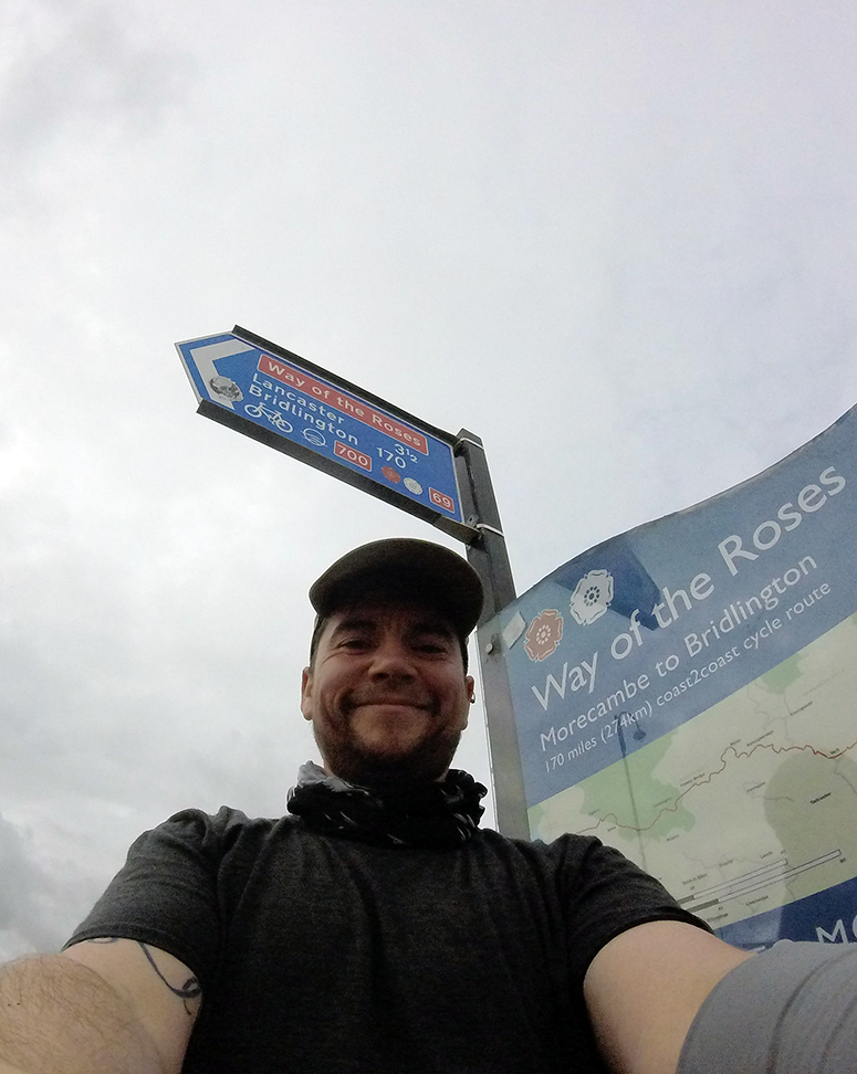
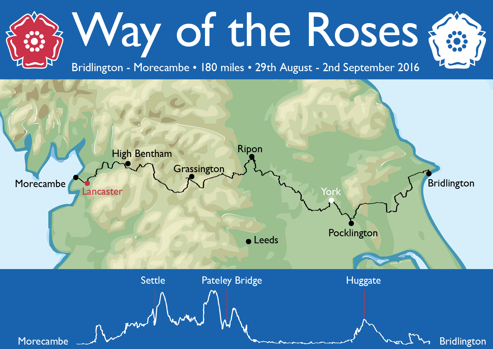
29/08/16 – Bridlington to Pocklington

It was the day that everyone went home from Leeds festival, so the train station was covered in mud and smelled stale.  Unfortunately a few folk were on my train to Hull and brought the aroma with them.  Second train to Bridlington was ok but full of beach-goers including a small child singing that song from ‘Frozen’.

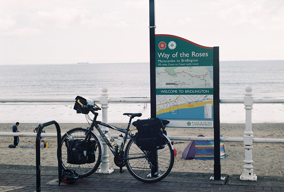
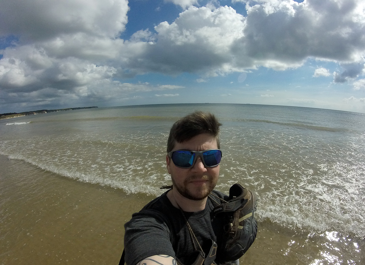
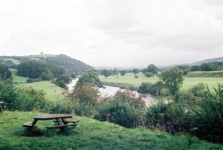
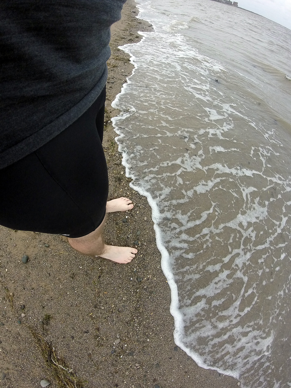
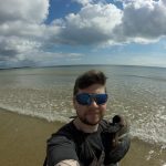
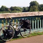
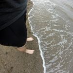
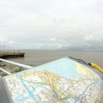
Arrived in Bridlington 11.30 am and went to the North Sands where the route starts.  It was busy, the weather was excellent.  Had a quick paddle in the sea; I’d rather dip my feet than my corrodible wheels.

Bridlington WotR start Paddling in Bridlington

The route left town up a little bit of a hill which would have been ok apart from the cars which mostly couldn’t be bothered to wait until the next passing place.  Past a Norman manor house at Burton Agnes followed by the first of many level crossings (counted eight over the course of the day).  These were either with lights and a barrier, or just a gate when on roads marked as dead-ends.  One had a kissing-gate which was just too small for my loaded, yet conventional, bike.  Anything more exotic would have struggled.  Signing however was excellent, most unusual for NCN routes; a few of the usual daft ways of crossing main roads but great on the whole.

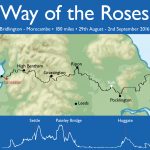
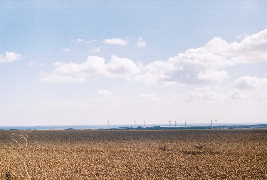
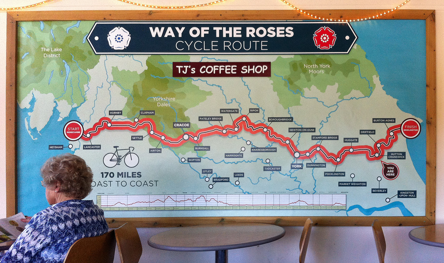
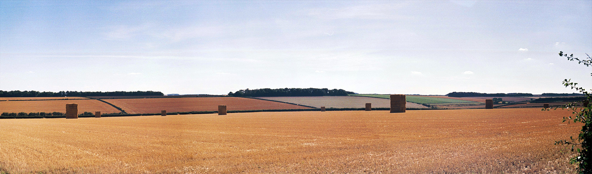
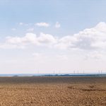
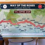
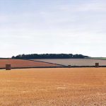
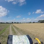
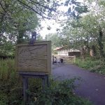
Through Nafferton (‘posh’ says my notebook) and to Driffield, where I stopped for (my own) food.  The route doesn’t go through the town centre so I don’t know what it is like.  Apart from the hills out of Bridlington it is fairly flat, with lots of arable farmland, wheat/barley and grass, and some tall reed-like things wth no clear edible part.  Leaving Driffield the route crosses the railway line three times in such quick succession that two of them are barely distinguishable on the map.  Past Skerne and on to Hutton Cranswick to cross an A road.  Just after this was a sign for a garden centre/cafe, and although my plan was to avoid too much cake I was flagging so stopped off to refuel.  They had a huge WotR map and I could see that the day’s ascent was about to start.

Towards Bridlington WotR route in coffee shop

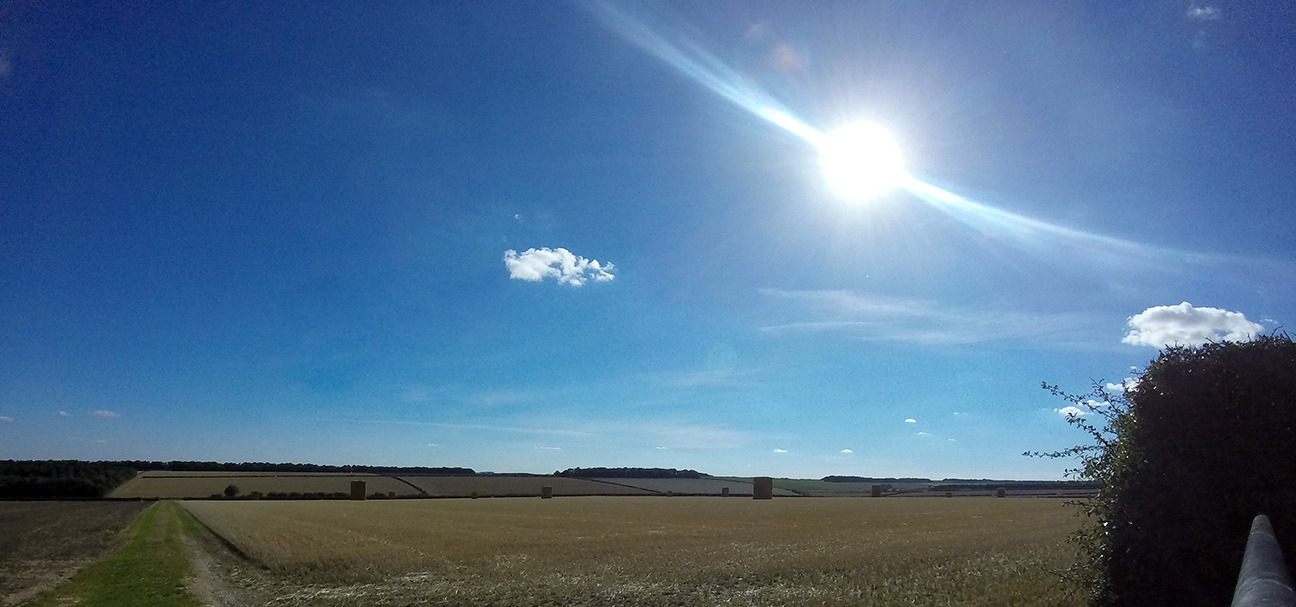
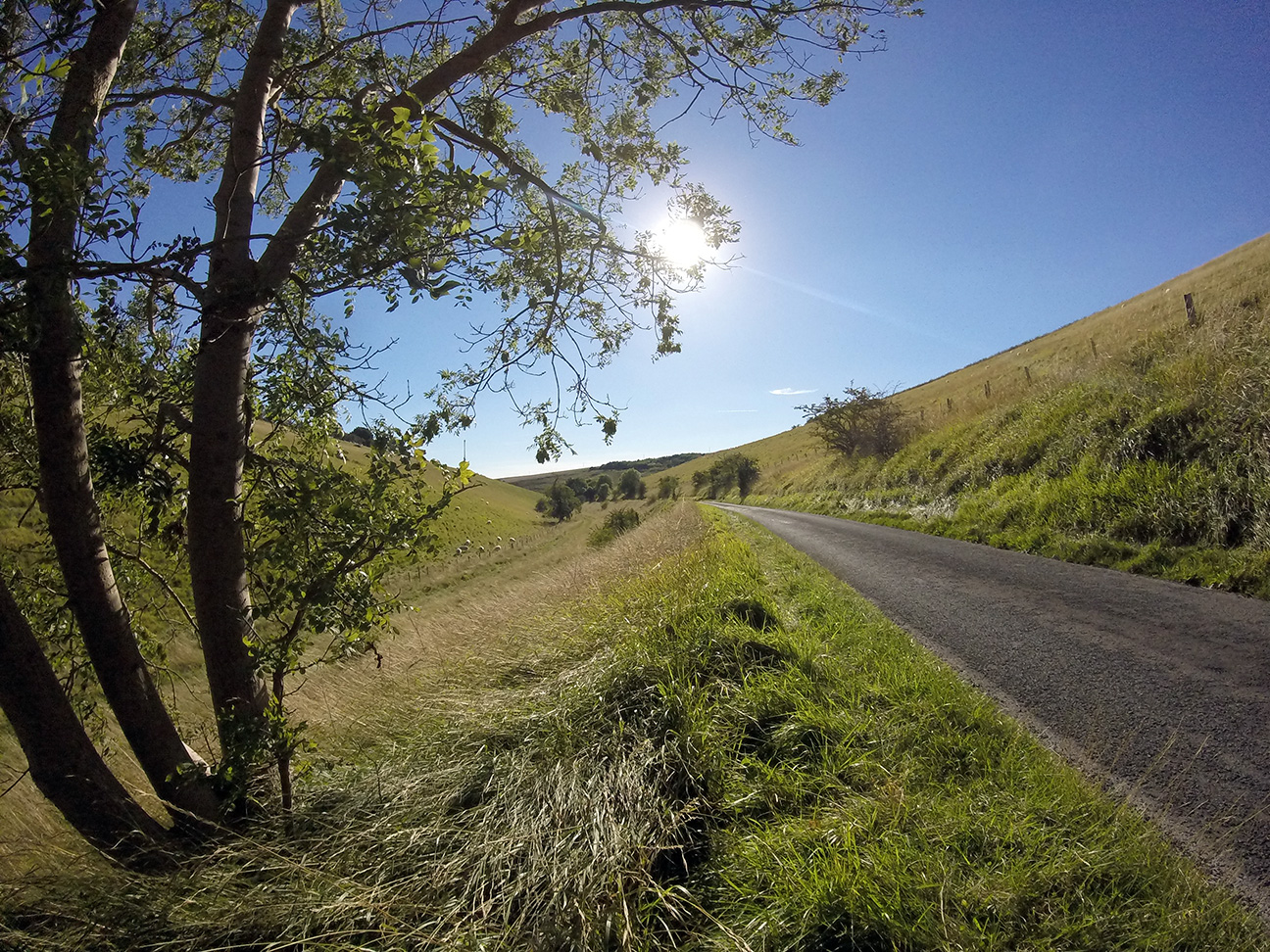
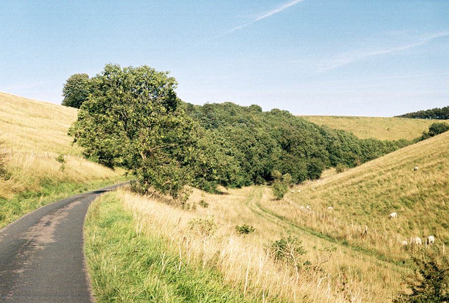
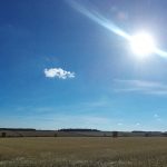
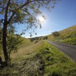
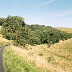
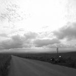
Just before the hills was probably the route’s flattest section, with lots of drainage channels and a road taking 90° turns, reminiscent of the roads around Glastonbury.  Then the climbing started, towards Tibthorpe, but it wasn’t too steep at any point, mostly a long slow drag.   After Huggate I thought it was all downhill but there was a little more climbing, then a sudden turning which went downhill through an amazing valley (river long since gone), with little tributary valleys.  This was a stark contrast to the flat fields, a little wrinkle in the smooth land.

Flat Yorkshire fields Flat Yorkshire fields Yorkshire Wolds Yorkshire Wolds

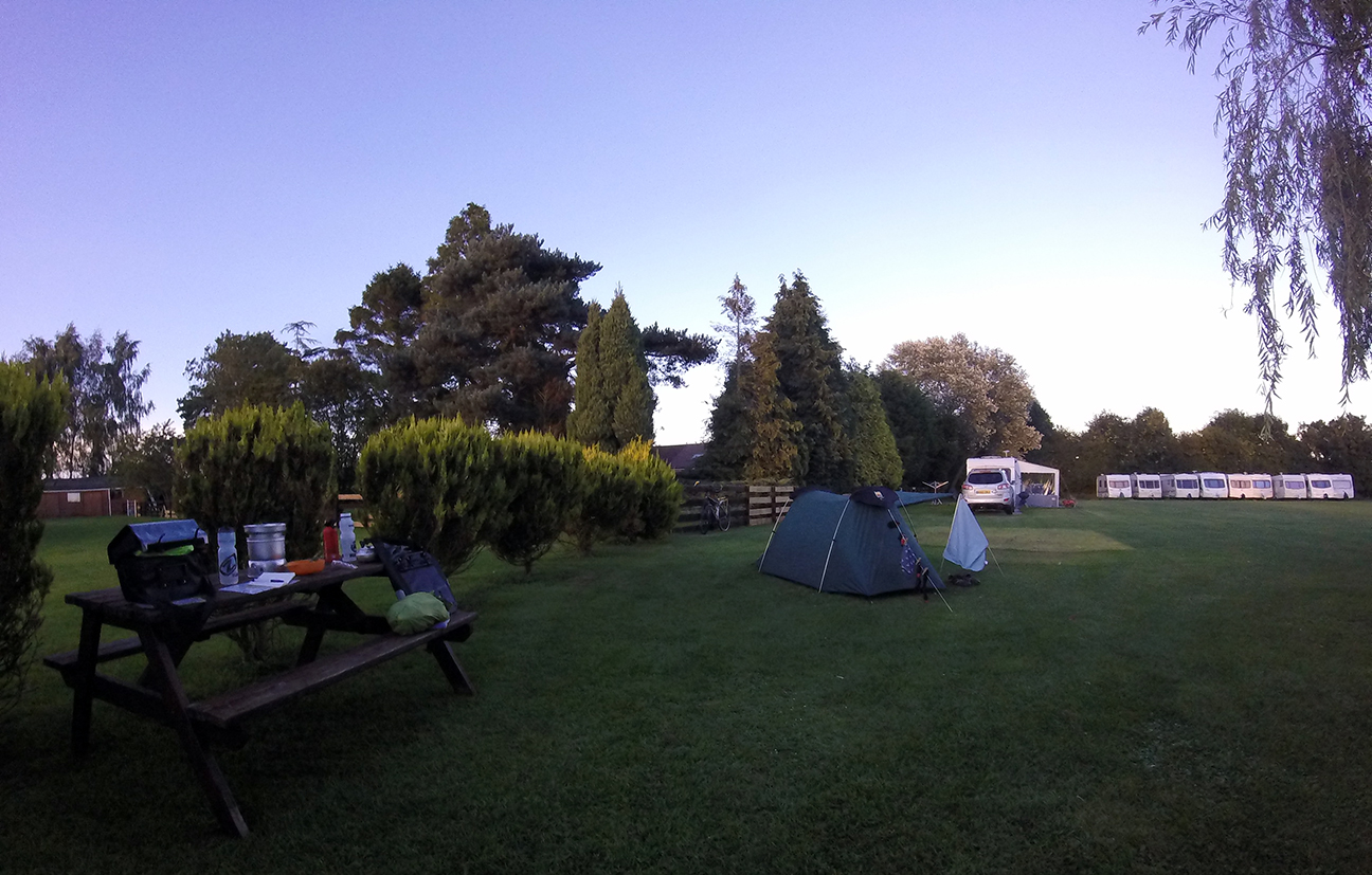
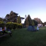
The route was downhill until a double switch-back where it left the first valley and headed to Millington.  I had marked a couple of campsites here from the WotR website but saw no sign of them.  I kept going, the route climbing up the other side of the valley which had me off and walking at one point.  At the top I met an old chap with a bike sitting on a bench, so I asked if he knew of any campsites.  “Campsites…(long pause)…campsites eh?”  Proper Yorkshireman.  After some further thought he gave me very helpful directions to a caravan site in Pocklington; always wary of places that don’t take tents but I saw a sign with a tent symbol on so became more optimistic.  Reception was closed but I rang their bell and a very friendly woman came over, directing me to a nice pitch.  Excellent site, mostly caravans; South Lea Caravan Park.  Very clean toilet block, flat stone-free ground with short grass, £10.  It was next to a busy-ish road so a little noisy.

At South Lea Caravan site

Roadkill of the day: stoat.

45 miles, average 9.9 mph


30/08/16 – Pocklington to Ripon

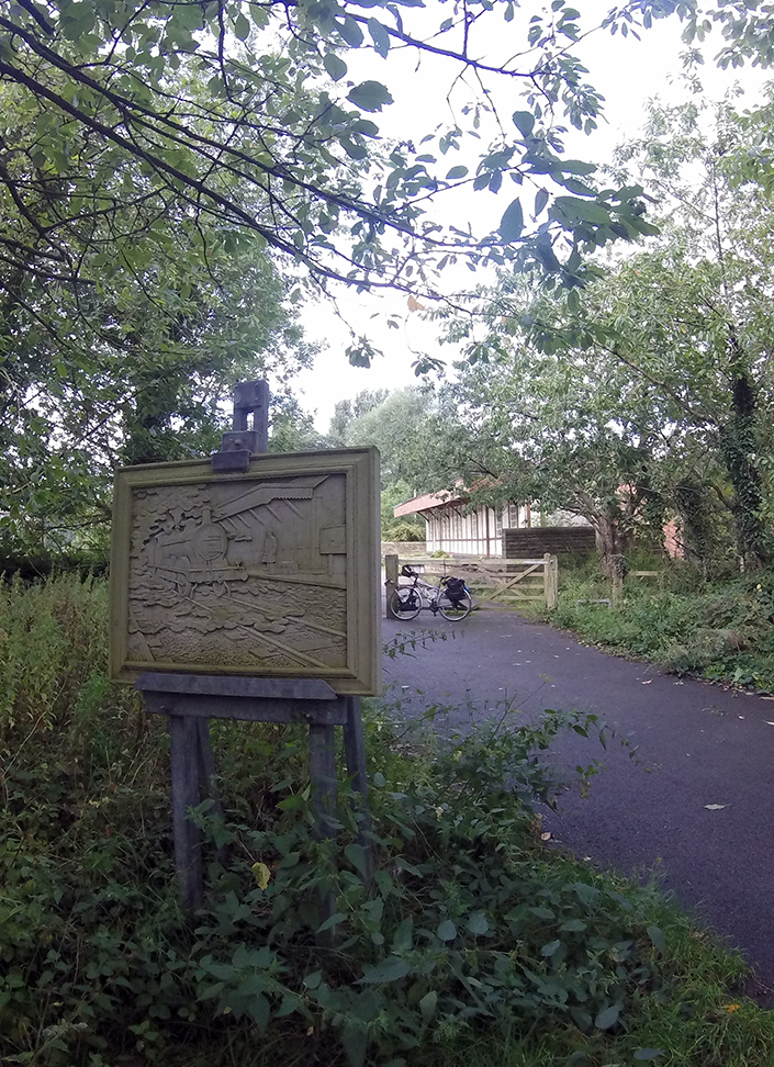
Left the campsite about 10 am which is acceptable for early days of a tour!  There’d been a heavy dew overnight but it was a sunny morning.  All flat to Stamford Bridge, where the route goes off-road on an old railway line path; the station building is still there and seemed to be used as a community centre.  After crossing the River Derwent the route runs along the A 466 briefly then turns along a road marked dead end/private estate.  Reaching a farm it becomes a bridleway and crosses a few fields; a wide track but bumpy in places, I’m sure it would be muddy if wet.

Bike in Stamford Bridge Bike and bridleway over field

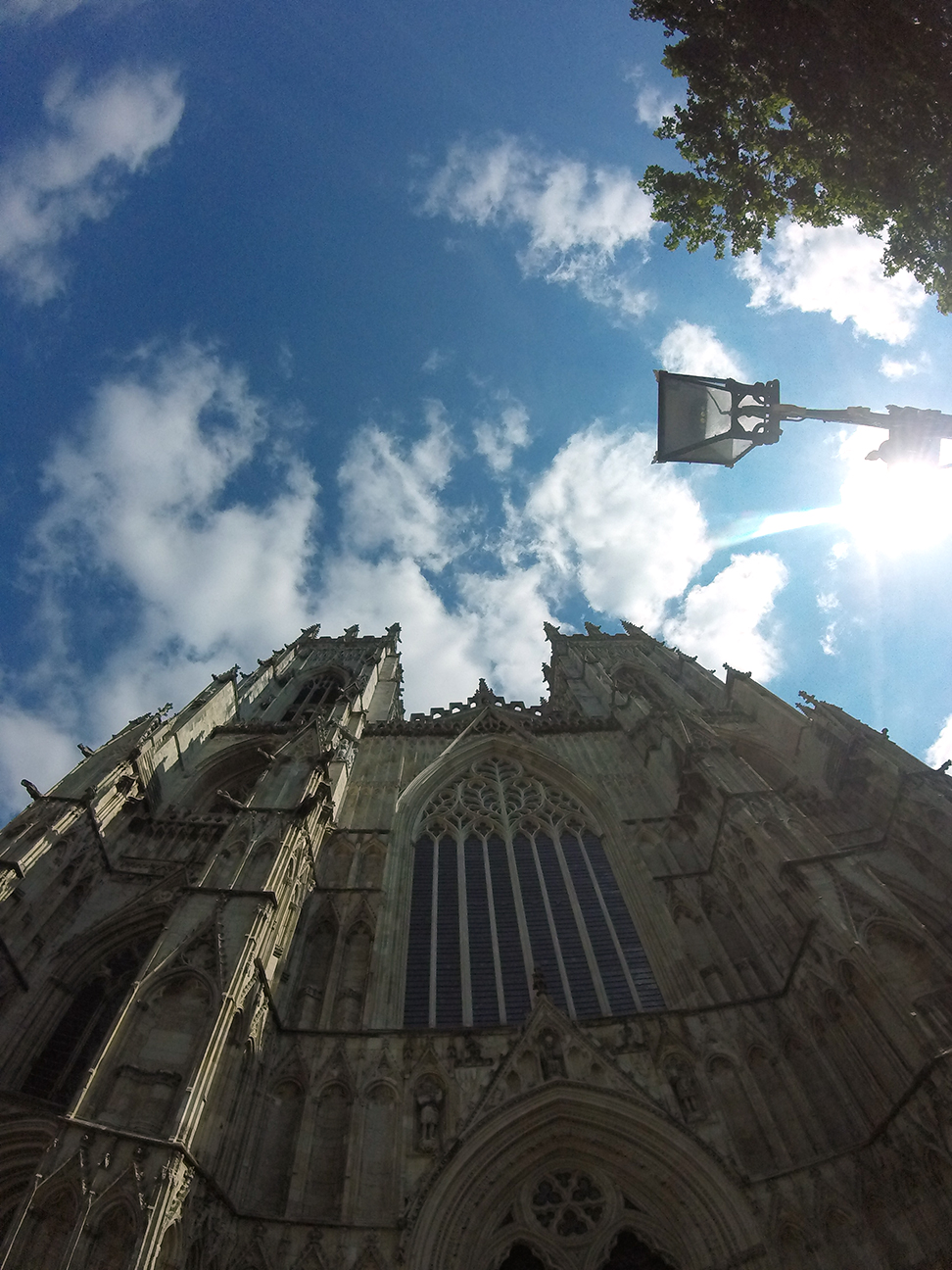
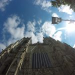
Road again at Dunnington then the route negotiates its way across a few A roads before passing through Oswaldwick.  The village has a stream running between the road and houses so lots of people have a little bridge in front of their houses.  Also lots of new building going on, huge houses by the looks of it.  More cycle path before crossing York’s inner ring road and arriving at the Minster.  Signs all good here, it was of course very busy and I found it difficult to find a bike parking space.  Eventually I found a space on a rack on a side street which involved having to climb over an adjacent stead to get out after locking up.  Got a tubigrip for my wrist in Boots; I thought I’d struggle with the reduced strength in my hand but rather it seemed to be vibrations in my wrist that were most uncomfortable and this was a great help.  An ice-blended coffee and a seat in the shade were much appreciated at this point.

York Minster

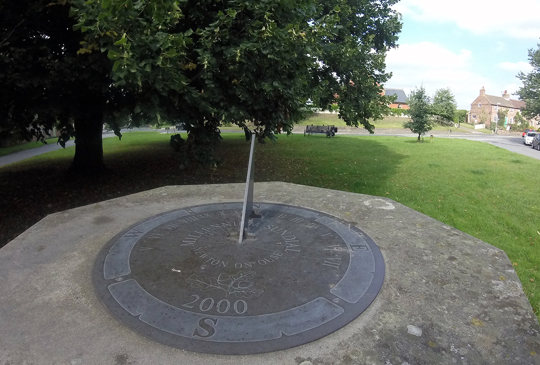
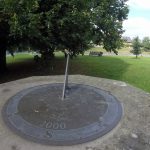
Now noticing the discomfort on returning to the saddle I headed out of the centre on a route that I recognised as I’d stayed on the same street for work last year; which was fortunate as there was no sign, but I remembered the way to the river.  A stupid example of a cycle route here included a step and much zig-zagging to get onto the cycle path.  Once there however this was traffic-free, quite a few other cyclists and pedestrians.  A wide area of grassland (Clifton Ings) reminded me of Oxford.  Then the route rejoins the road, under then over the railway to touch an A road near Shipton.  Then on to Newton-on-Ouse, another expensive-looking village.  I stopped on the green to eat and tried to work out the time by the sundial, which looked like 2.30 pm but the local church chose that moment to ring a single chime.

sundial

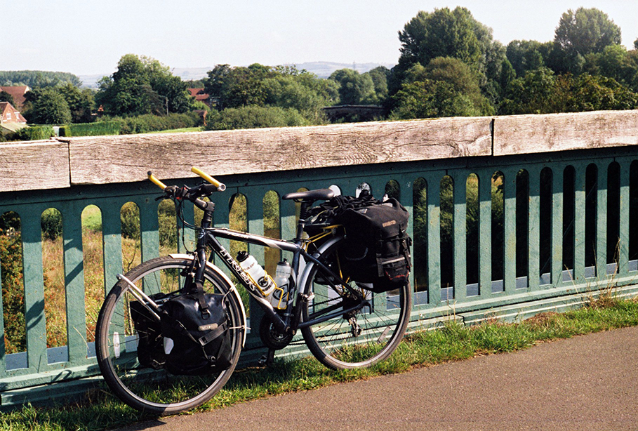
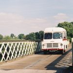
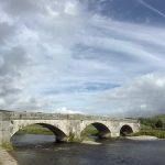
Through Linton where there is an RAF base, the planes looked old to my ignorant eye, not the fast jets I associate with military use.  The route then crosses Aldwark bridge which has a toll, although bicycles are free.  It did seem rather rickety.  Happily my crossing coincided with that of a vintage camper van which suited the scene, the driver chatted to the toll keeper and it sounded like an annual gathering was just dispersing.

Toll bridge

Shortly after I was passed by some cyclists I had seen having a break by the bridge; a tandem complete with small dog in a rear basket and a friend drafting them.  Approaching Boroughbridge I saw a farm selling eggs and apples (Discovery), bags of six apples were £1 but I had no need of so many so I took one and left 20 p.  An early first apple of the year.  On the way out of Boroughbridge are some impressive standing stones, two in a field and one by the road with some information.

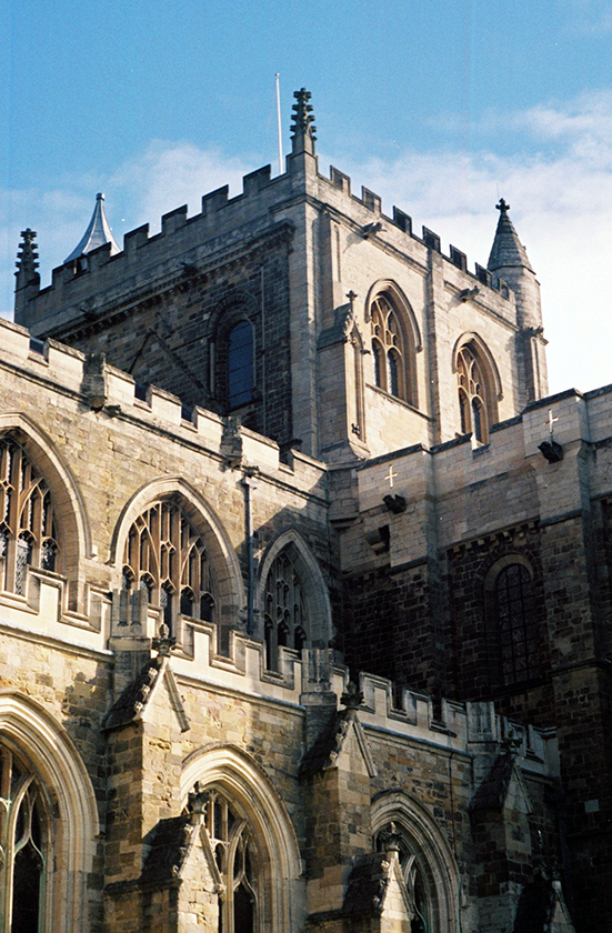
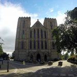
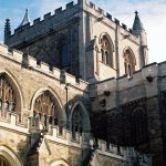
Then the route goes under the M1 (I made a note that junction 48 is the nearest for next time I’m driving and bored) before entering Ripon. I stopped at the cathedral before looking closely at the map, and realised the campsite marked would involve a little back-tracking.  It was not very well signed and required an unpleasant crossing of a dual carriageway roundabout.  Lockside Caravan Park is a small site, near the race course the commentary from which was still going at 7.30 pm.  Fairly basic but decent condition, £6 plus 50p for a shower.

52 miles, average 9.9 mph


31/08/16 – Ripon to Grassington

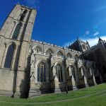
Another 10 am start, there was a brief shower just before I packed up, and it was sunshine and showers all day.  I was lucky and avoided most of the rain, only needing the waterproof for one downhill section to keep warm.  I returned to Ripon Cathedral after passing it yesterday to get back on the route.  After going around the central streets I came to a junction with WotR signs pointing both left and right, with no indication which was the east and which the west route.  I followed the ones pointing in the direction I was headed based on the town names…which was wrong as I ended up back at the Cathedral.  Back to the sign and I took the other option.

Ripon Cathedral Ripon Cathedral Ripon Cathedral

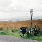
On to Studley Roger and in through the grand entrance to the National Trust Water Gardens/Fountains Abbey estate.  Up following a ‘no cars’ lane, past a little church and out onto another road.  No real sight of the Abbey but I have visited before.  Then passed a car park which I recognised from that visit before continuing along lumpy roads – I was finding the hills here hard work, like Cornwall where they are steep up and down all the time.  Quite a headwind all day too.

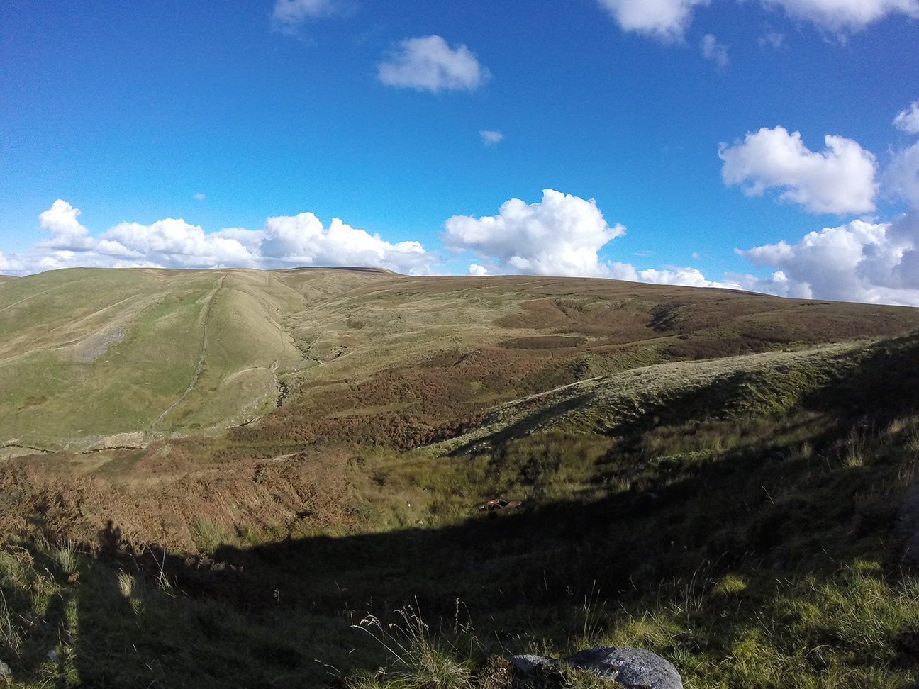
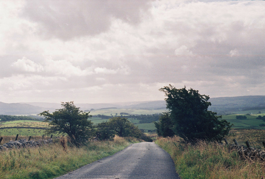
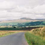
I had a brief stop at Brimham Rocks for dried fruit, definitely in need of sugar by this point, then fortunately mostly downhill through Glasshouses and into Pateley Bridge.  I covered the laundry drying on my rear rack as the clouds looked dark, and visited a nice tea shop on the downhill section of the main street.  Crazy location for a town, such a steep valley.  On leaving I was confronted by a very steep B road out of town which I had to walk up.  It was marked as 16 % and it just seemed to go on and on.  There were road signs at the top and bottom warning of slow cyclists but it was still hairy going, lots of bends so hard to stay visible to traffic (which would have been much different if I had be riding).  Somewhere around Greenhow it levelled out a bit, clearly high up with great views of Nidderdale north and south.

Pateley Bridge Nidderdale

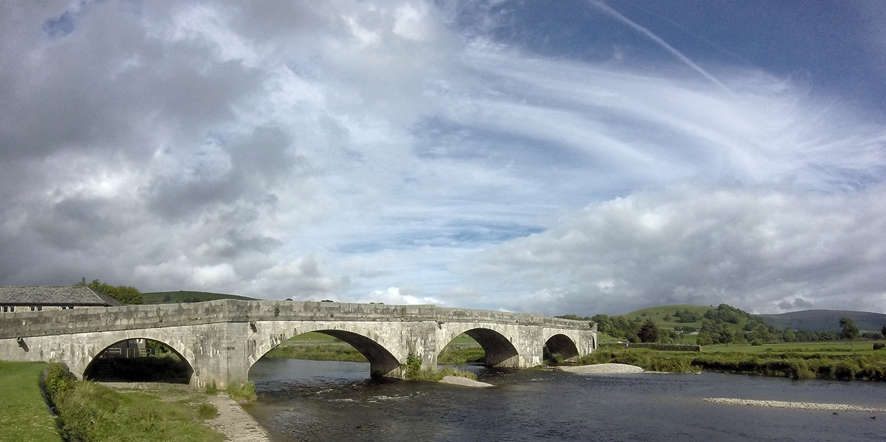
Of course the wind was stronger on top.  I stopped at Stumps Cross Caverns, just for an ice cream  but I’d like to come and visit the caves sometime.  I hadn’t covered many miles so far so back on the bike into a strong headwind and a bit of rain, though at least mainly down hill to Appletreewick.  Then through Craven Arms (‘Gateway to the Ales’ – very tempted to stop here especially as there was a nice looking campsite) and I recognised a pub from an audax which went in the opposite direction along this section.  On through Burnsall which looked like a nice place.

Burnsall

Shortly afterwards I decided to leave the route and continue on the B6160 to Grassington, thinking there was more hope of finding a campsite around the town.  I did starting looking at bus shelters on the way… A steep climb with a bit of walking up to the town centre and I spotted a hillwalking shop so went in and asked about campsites.  The guy in the shop said there was one near Threshfield which was the closest and gave helpful directions.  Still tired so I stopped for a can of coke and white bread sandwich from the local spar (sugar required, not my usual cuisine at all), plenty of nice cafes/pubs for the less messy/fragrant visitor.

I found the campsite (near Skirethorns), I do wish they were signposted from further away though.  It was a very small place at the back of a farm, basic but functional, £6. There were two other tents there when I arrived, one small with a couple plus little dog having a BBQ, and the other a large tent with a couple who were playing Rick Astley and taking loudly.  Later they watched Emmerdale and Corrie and had a row.  I pondered the consequences of cutting the cable to their satellite dish.

34 miles, average 7.5 mph


01/09/16 – Grassington to High Bentham

It felt like September this morning, I could see my breath and had to put my jumper on.  I got up a bit earlier and left around 9 am, hoping that my clattering woke the TV watchers.  A sunny/cloudy day, the wind was not too strong but again blowing in an unhelpful direction.  I left Threshfield and took the B road to Cracoe to rejoin the WotR route, which then goes to Aireton via Hetton and Winterburn, which was lumpy but no walking required.  The next section over Scosthrop Moor involved more up, although it was a long slow climb so also all ridable with good views from the top.

Scosthrop Moor Scosthrop Moor Scosthrop Moor

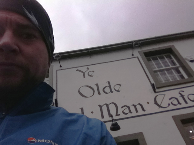
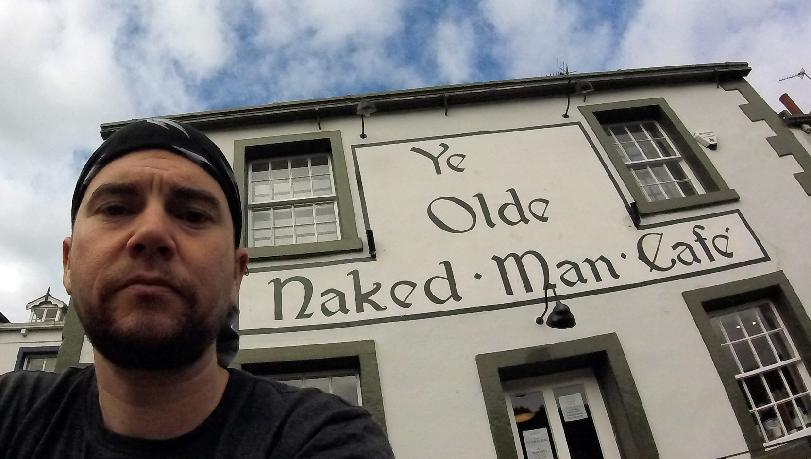
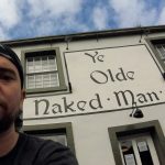
There was a steep decent into Settle, where I stopped at Ye Olde Naked Man cafe, chosen on the basis of the name but recommended for quality also.  Their benches outside seem to double as a bus stop which explained the sudden appearance of a number of folk of advanced years while I was inside ordering.

Cafe in Settle

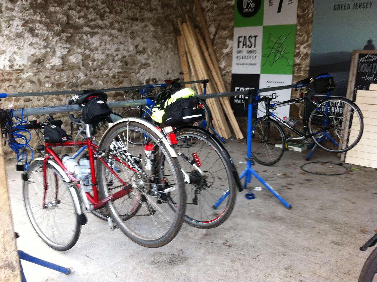
Then I went into the tourist information centre to see if I could find a campsite that I could get to at 4 – 5 pm, probably near Gressingham.  It was staffed by classic National Trust-style old lady volunteers, who were lovely but despite their best efforts devoid of knowledge.  This took quite some time while one of them (who lived in Bentham) wracked her brains, and was also interrupted by another visitor looking for their wi-fi, at which point the other read out/showed him the instructions that she had which clearly could have been written in arabic for all they made any sense to her.  He managed anyway.  When eventually ready to leave I found I couldn’t get my bar bag to clip in to the holder, and after much faffing realised that the angle of the holder must have changed slightly so that the gear and brake cables were now in the way.  There was another chap with luggage (not quite as much) fixing a puncture, he seemed only to have one tyre lever so I lent him another.

Having stopped for way too long I wondered where to aim for for the night, and planned to see how things were going when I got near Bentham where I was reasonably confident of a campsite.  The route leaves Settle and heads up Ribblesdale, on presumably the more undulating side than the B road and railway line follow.

Ribblesdale

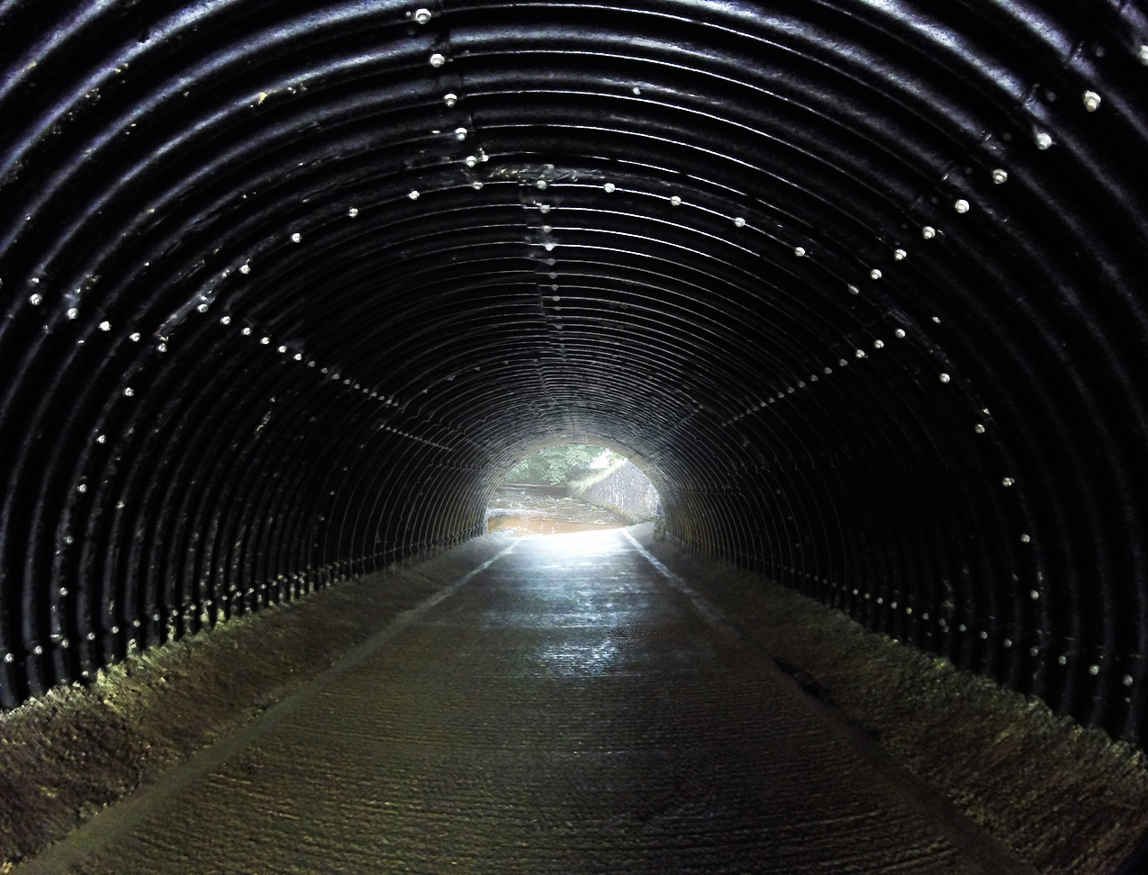
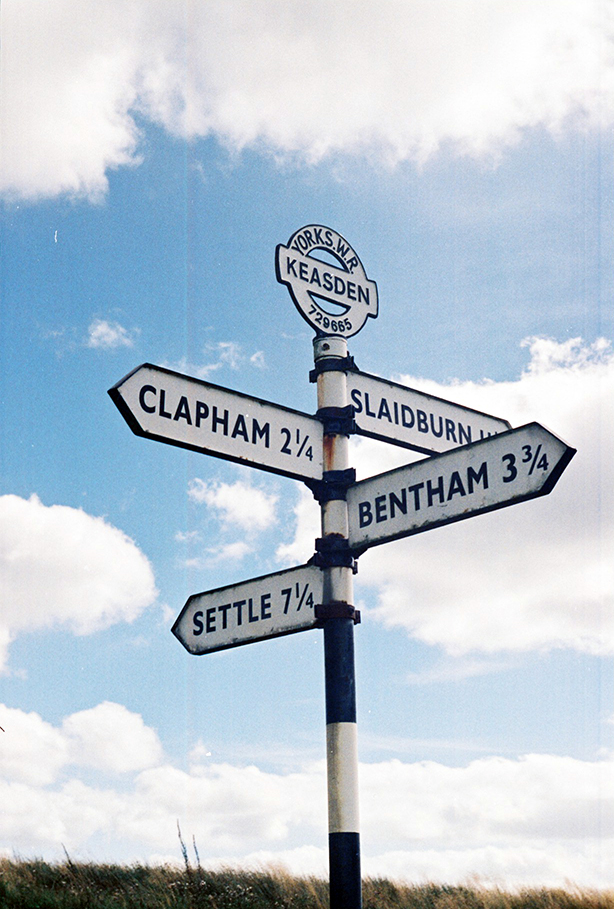
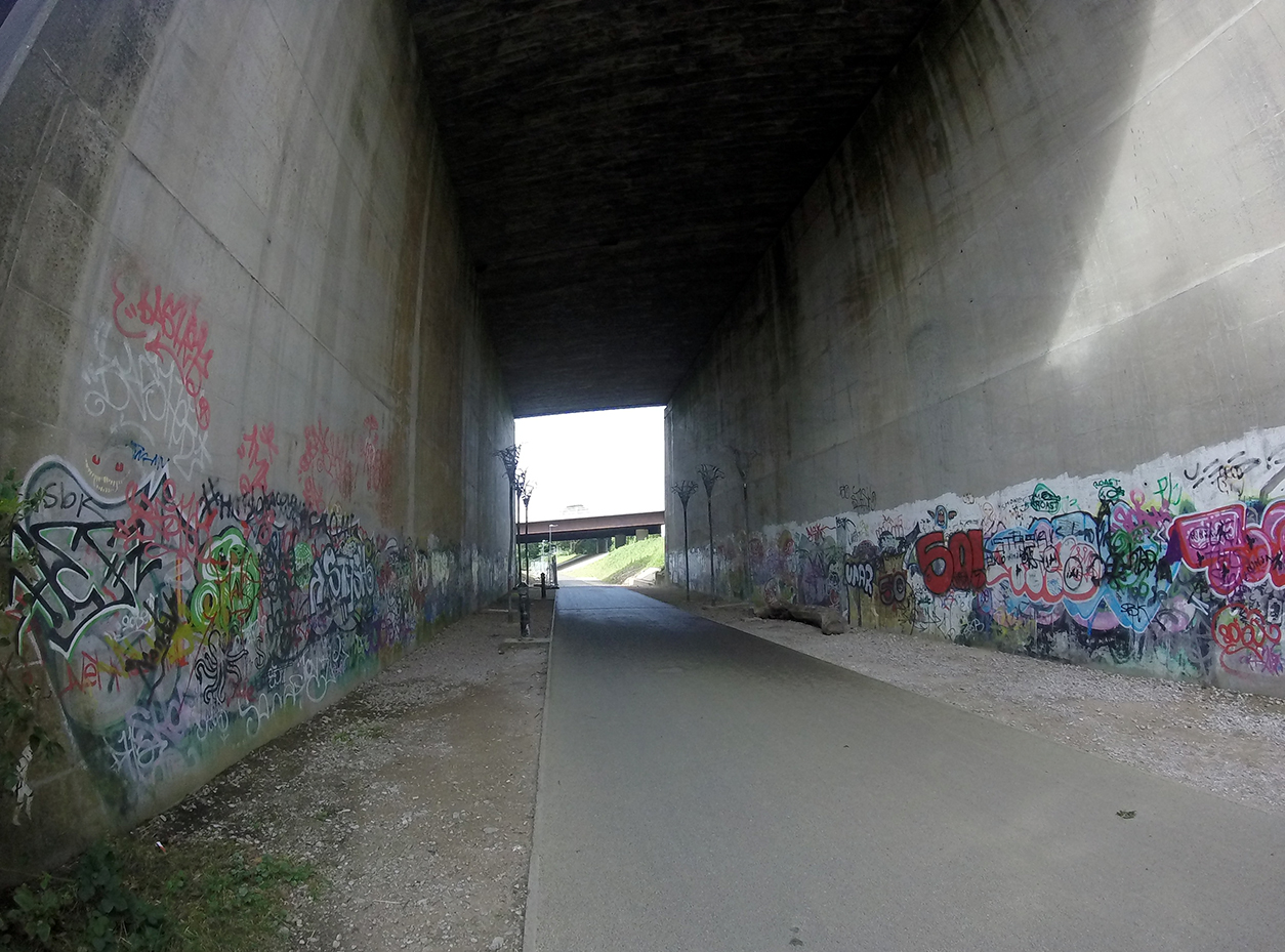
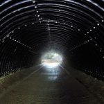
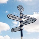
Then it heads west to Austwick before meeting the A65 where a short section of cycle path has been reclaimed from a field.  Then up to Clapham, yet another nice village.  It was tempting to stay on the B6480 straight to Bentham but felt like cheating to take the easier option. There was an underpass under the A road shared with a stream, and then the roads leads to Clapham Station.

Underpass

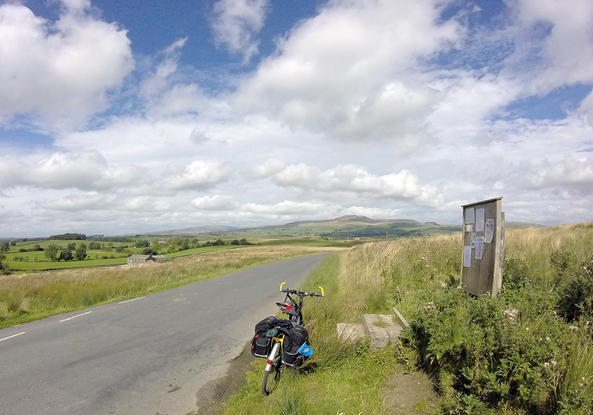
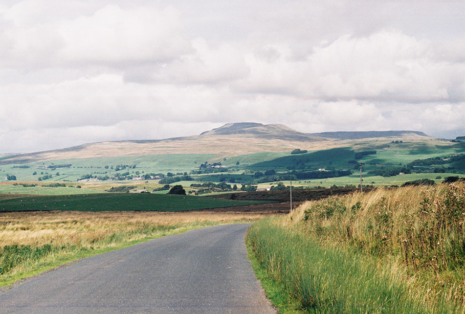
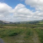
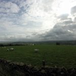
There was a steep section after this which required a bit of walking, up to a crossroads at Neasden which offered nice views towards Ingleborough then along the south side of the Bentham valley.

Keasden crossroads Keasden crossroads Keasden crossroads Ingleborough

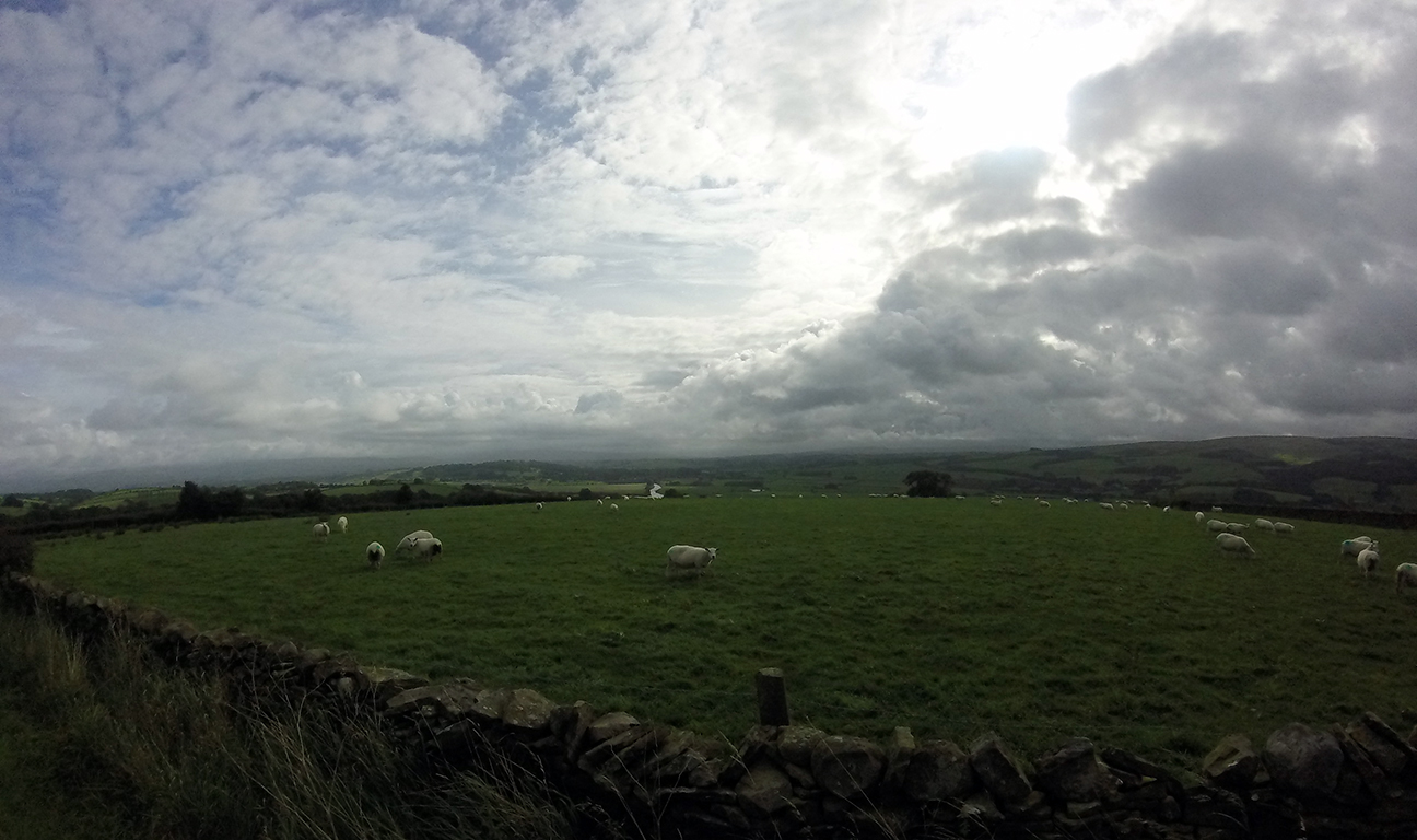
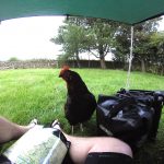
By now I’d decided that aiming for Morecambe was over-optimistic and liable to end in my arriving late so thought High Bentham a good bet for finding a campsite.  Initially I couldn’t see any sign of the site which was marked on the map, but I stopped in the village which had a sort of tourist information place which was a tiny room at the front entrance to the town hall.  Although closed you could still get in and I found a list of local campsites; two annoyingly back towards Clapham but they at least confirmed that they accepted tents whereas several others appeared to be caravans only.  Happily the first, Curlew Camping, was open.  It’s a small holding, with chickens and a few sheep, run by a slightly odd but very nice chap wearing a grubby ‘caving rescue’ t-shirt (and a couple of caving dry suits hanging up by the stable).  One toilet and shower in a small room attached to the side of the house, covered in notices and posters, very characterful.  £6 or £7 with car.  Views south towards the Forest of Bowland; north Ingleborough and Whernside would be visible from slightly higher.

A hen came to see me as soon as I’d arrived, she’s obviously learned that campers = food and I gave her a bit of oatcake, although she would peck anything that had potential (clothes pegs, hands, etc) and was quite happy to stand on my bare foot to get closer.  One other camper, also a cyclist who was driving up north but having a few stop offs on the way.

hen

31 miles, average 8.3 mph


02/09/16 – High Bentham to Morecambe

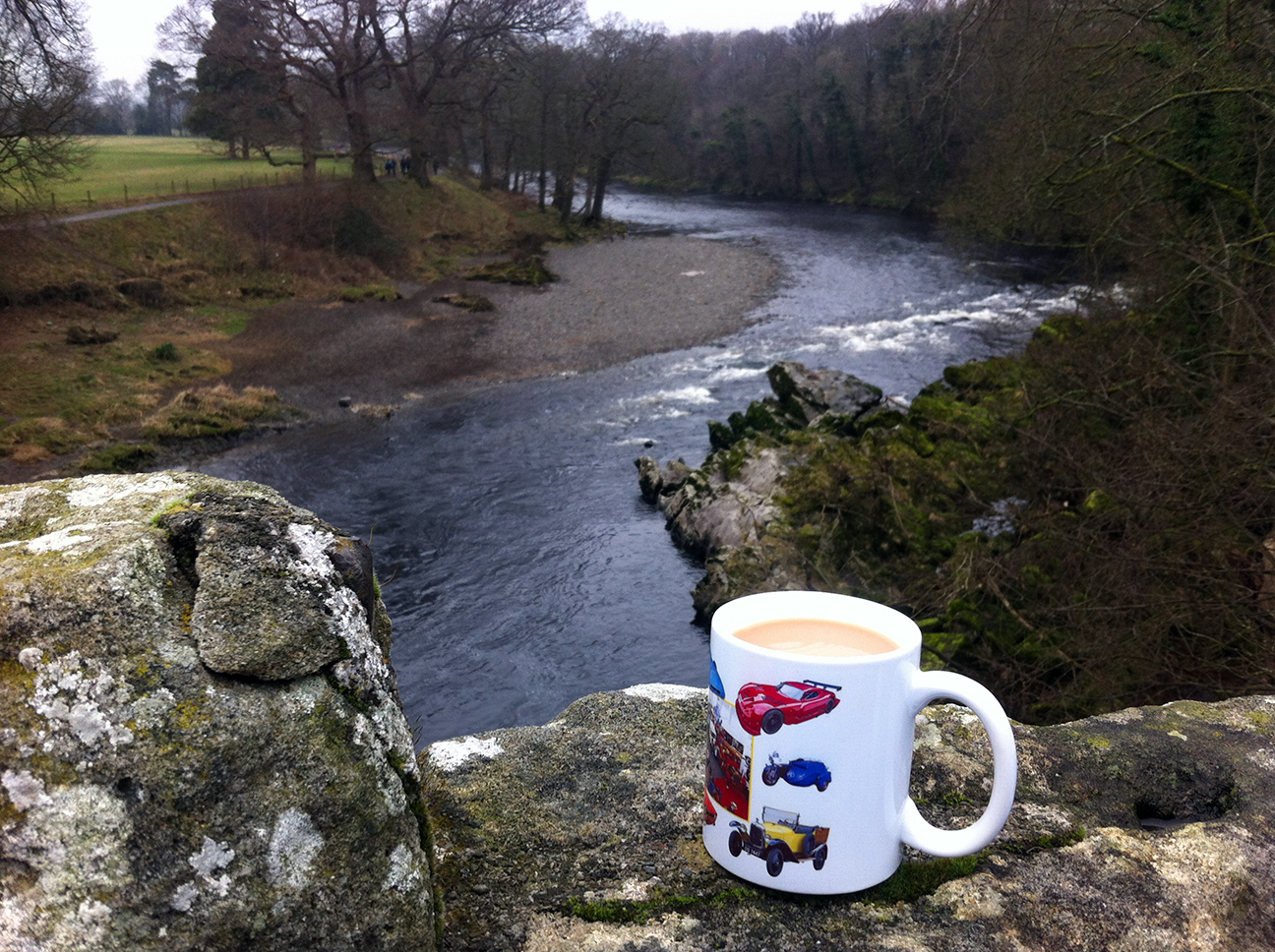
It was quite a wild night with wind and rain, and I wished I had put the extra guy ropes on but there was no water ingress and happily the rain had stopped by morning.  I left about 8.30 am and followed the B road back through High Bentham and on to Low Bentham and Wennington to Wray where I rejoined the WotR route.  Wennington was the first place in Lancashire but sadly there was no welcoming sign to photograph.  The route signage was not quite as good once over the border and I was glad to have the map on a small stretch of A road through Hornby.  Then over the River Lune to Gressingham.  Lumpy (no walking required) roads over the north side of the Lune valley until eventually down hill (for good this time) through Halton Park, where there was no grand house visible but the grounds were ‘kept’ with short grass and mature trees.  I had a stop at Crook of Lune, a sharp bend in the river, where there was a little cafe (Woodies) where I had a coffee in a proper mug and tiffin from yesterday’s cafe in Settle – always stay one snack ahead!

Lune Valley Crook of Lune

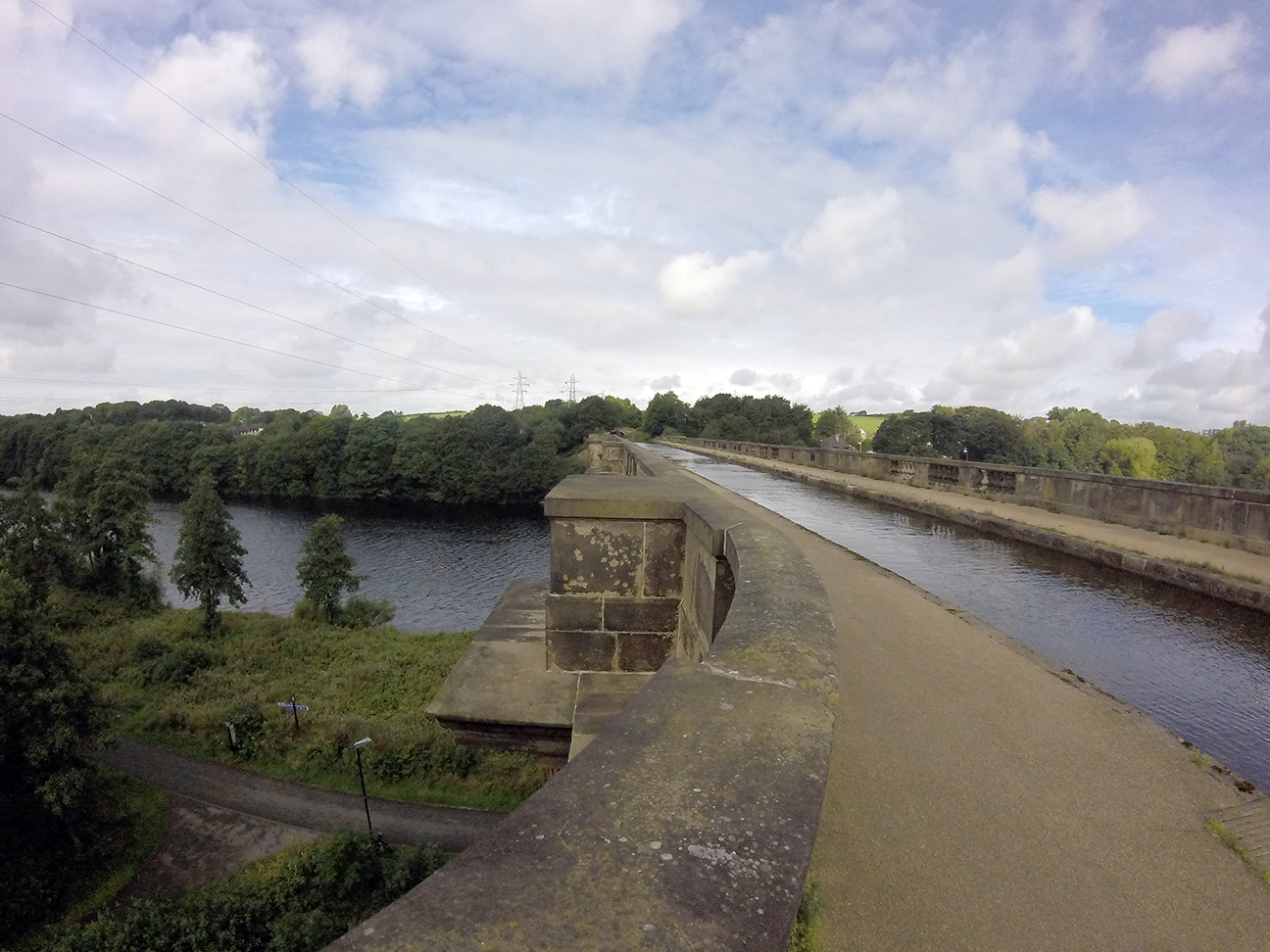
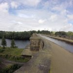
From here the route followed the Lune to Lancaster and was traffic free all the way to Morecambe, so easy going.  It’s old railway line, a very good shared route (apart from when a group of MAMILs came the other way like they owned it).  I stopped to check out an aqueduct where the Lancaster Canal crosses the river.

Near Halton Under the M6 Lancaster Canal/River Lune aqueduct

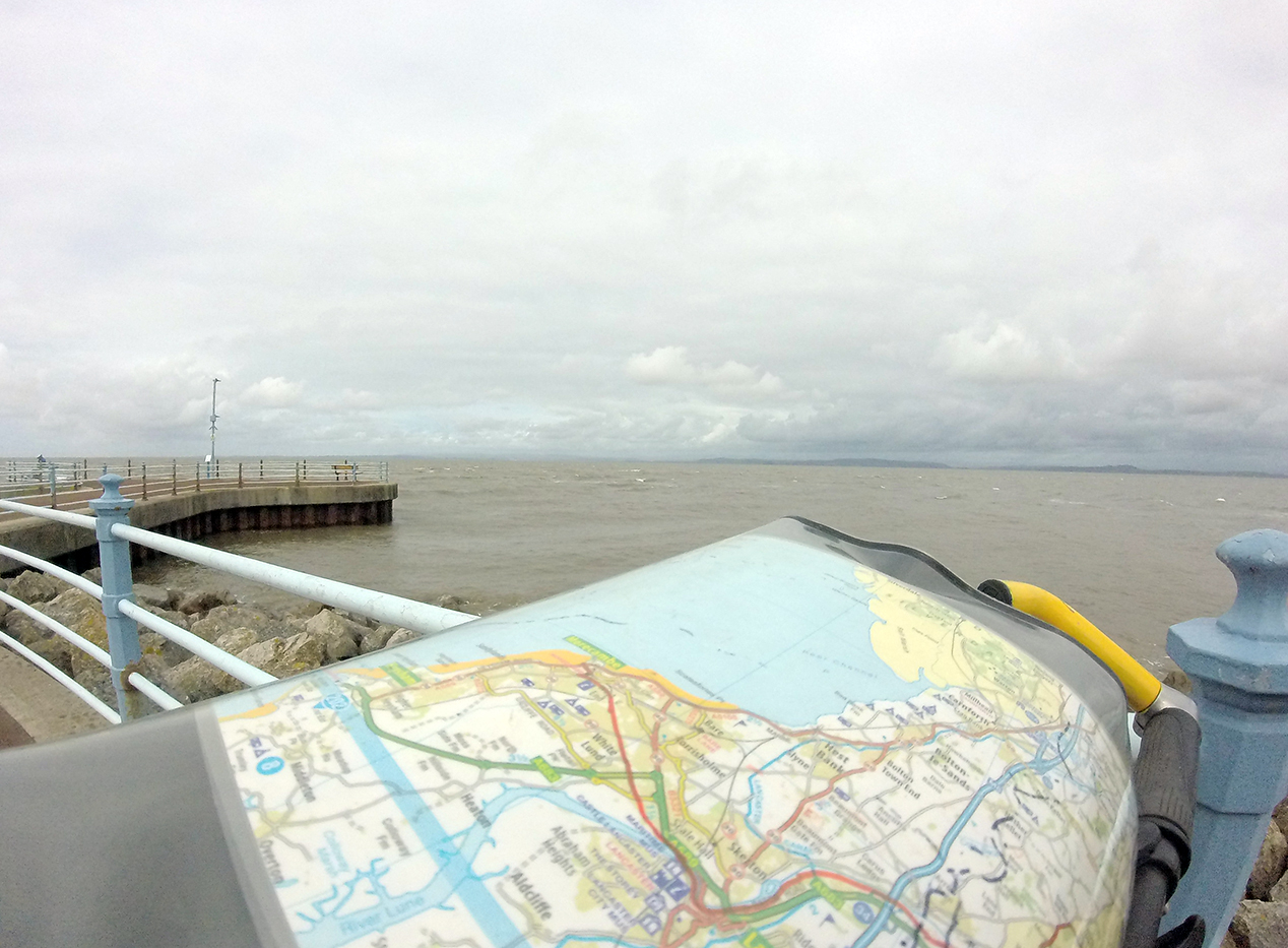
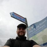
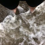
You don’t see much of Lancaster although I’m sure it would be easy to stop off and explore the city.  Crossing the river in Lancaster the signs were confusing and I ended up on a three-lane A road rather than the intended shared-use bridge.  Back on track to Morecambe and the traffic free route continues with frequent signed turn-offs to bits of town – great if you live here I imagine.  More confusing signs on reaching the end of the path around the train station, so I just followed the road signs for the promenade and found the official end (start) of the WotR route.  I had a paddle in the sea then a cruise up and down the promenade which is nice and wide, shared pedestrian/cycle/horse and cart use.

Morecambe WotR end Paddling, Morecambe Paddling, Morecambe

Sea at Morecambe Morecambe WotR end

The town seemed a bit of a dump, a main feature being a large tower sponsored by Polo.  I couldn’t even find a Weatherspoons for a celebratory pint and wi-fi so went to the train station.  The direct trains to Leeds are few but there was one due half an hour later so I headed home.  Finishing had been a bit of an anticlimax, probably because this was such an easy final day, and I had taken a day longer than I’d hoped.  The trip was a bit of a last minute decision, if I’d had more time I’d have planned my campsites better and probably completed it in four days.  Of course it has been done within 24 hours…although with less luggage.

23 miles, average 9.4 mph


WotR map