cycling

Tan Hill Inn

31/03/16

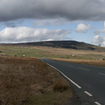
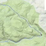
An excellent day to cycle up Arkengarthdale from Reeth to the Tan Hill Inn, then back down through Swaledale.
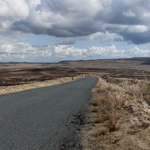
The two valleys are very different in character; Arkengarthdale is barren, with a view to the north of the distant A66. Today it was full of the noise of curlew and lapwing.

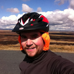
Arkengarthdale Ducks Bridge over the Arkle Beck A friend knitted me these helmet ear-warmers road over Arkengarthdale Moor West Stonesdale

Swaledale is more sheltered and filled with the classic walled fields.

Fields in Swaledale Fields in Swaledale Curlews Return beer Fields in Swaledale

28 miles. 2,500 ft climbed

Wales 2015

04/07/015 Holyhead − Bangor

Arrived at Bangor station around 3.30 pm, rode to the marina area to try and find the official start of NCN 8; nothing obvious, just a few bike signs with something else on them.  Tried to get a sandwich in a pub but they had stopped serving 10 minutes previously.  Several cafes closed, found one still open but which had also stopped doing food, so settled for coffee and a sandwich from the Co-op.

Holyhead, start of NCN 8

Stuck to the A5 rather than try and follow NCN 8/5 here; with the A55 running parallel it was pretty quiet.  Good weather, fairly flat and a light wind.  There was a nice path/cycle track over the causeway from Holy Island, the tide rushing through a channel in what looked otherwise solid.

Milestone on Anglesey Menai Bridge Camping dinner Bangor

Over the Menai Bridge, which is quite narrow so difficult for cars to overtake but it’s not very long.  The campsite at Treborth Farm was just over the bridge, nice place but quite expensive at £16 plus £1 for the shower.  Not a quiet evening, first some nocturnal activities from a couple in a nearby tent who had perhaps overestimated the sound proof properties of nylon, then fireworks (independence day?).

Holyhead - Bangor map

24 miles


05/07/15 Bangor − Porthmadog

Weather good and ready to leave at 9 am, at which point there was a sudden downpour.  It seemed like an odd shower until later when the rain set in properly.  Followed route 8 signs on and off to Caernarfon, the usual daftness of avoiding the road in places, although useful to find my way out of Caernarfon, my coffee and bara brith stop.

Welsh flags in Caernarfon Caernarfon Caernarfon

Going south the route goes off-road, following a narrow gauge railway.  There were a few groups of blokes working on the line including some around a very rusty old engine.  It looks like the line goes all the way to Porthmadog but goes east inland at Dinas whereas the cycle path continues south along what looks like another old train route, a very nice section.

Cycle path NCN 8 Welsh railway Welsh railway Welsh railway 

The ride became a bit of a drag, into the wind and the sort of gradient that you can’t tell if it’s up or down, and then the rain started.  The route joins the ‘road’ – which is a very steep concrete section with lateral lumps in, through a farm.  I had already planned to divert to the more sensible B road here, which I followed to Criccieth.  I found a great tea room with a waitress sympathetic to my dripping.  Welsh very widely spoken here.

Cycle path and rain Rain approaching Criccieth

Stuck to the main road to Porthmadog as it was still unpleasant, and found the campsite at Tyddyn Llwyn fairly early.  A big place equipped with very welcome tumble driers, and a pub/restaurant on site.  Mostly static caravans, and my only complaint was that the tent pitches were not on very flat areas.

Campsite Porthmadog Bangor - Porthmadog map

32 miles


06/07/15 Porthmadog − Dolgellau

Rained all day.  As advised the bridge from Minffordd to Clifor was closed (due to reopen the following week) so I took the detour up the Vale of Ffestiniog to Maentwrog and back down the other side.  There were road works with traffic lights on the return section and it was only when I got to Clifor that I realised how long they were, and that a large queue of traffic had been at waiting for me to pass.  Good job I didn’t stop to take photos.

NCN route 8  Vale of Ffestiniog

I decided to stick to the A496 rather than the 20 % gradient on offer on route 8, a B road to Harlech.  This turned out to be an excellent choice as most of Harlech is high up and this was a more gradual way to approach it.  I stopped for allegedly one of the best scones in town (no complaints) while successfully struggling to resist a full ploughman’s.  Seemed quite a well-to-do place, and a UNESCO heritage site.  Some building work around the castle looked like a new bridge for visitors.

Harlech castle

Continuing along the A road to Llanaber I rejoined NCN 8 where a very steep path takes cyclists and walkers down and along the promenade to Barmouth.  Over the Mawddach is a bridge for trains with a board walk for bikes and pedestrians; there was a closed toll office and a few weeks after returning home I saw (and signed) a petition to the local council to keep the bridge open to cyclists.

Llanaber Llanaber promenade Barmouth bridge toll office Barmouth bridge toll office Barmouth bridge

Once over I failed to find route 8 for a while, at last it appeared by the road at Penmaenpool and I followed it to Dolgellau.  Cooked under the tent’s porch in the rain and changing wind.

Trangia porthmadog - dolgellau map

39 miles


07/07/15 Dolgellau − Machynlleth

A nice quiet road out of Dolgellau winds uphill before crossing the A road of the Bwlch Llyn Bach and then heads straight up what is not much more than a farm track; a long walk pushing a loaded bike.  I met a few D of E-ers coming the other way, complaining about their walk and wishing they had wheels.

NCN 8 near Dolgellau NCN 8 near Dolgellau NCN 8 near Dolgellau NCN 8 near Dolgellau

At the top was an almost alpine view of the valley down to Aberllefenni, and I could get back in the saddle.  Some slate mines in the very steep hillsides just before joining the road to Corris, where I stopped in a very busy little shop/cafe.

NCN 8 to Aberllefenni NCN 8 to Aberllefenni Slate mine near Aberllefenni Corris train station

Although the weather had been much better today I stopped fairly early in Machynlleth.  This was the last place with a train station along route 8, and if I went further I was committed more or less all the way to Cardiff.  I had a train booked but no contingency time, and aware that the longer and hillier days of the route were still to come I decided to stop here for a few nights and return home via Manchester.

NCN 8 near Machynlleth Campsite near Machynlleth Campsite near Machynlleth

I camped at a site near the Centre for Alternative Technology, a couple of miles north of town.  There was no hot water when I arrived but I think that was the fault of the large D of E group that had arrived before me.  It was very windy and the lads group kept having to chase after various bits and pieces to stop them being blown into the river (Dulas) that ran past the campsite.  My tent, once up, survived the wind and the rain that passed in the night very well.  There was another cyclist called Anna also doing route 8, including a detour to Hereford for a party.  She seemed to be travelling fairly light, no front panniers, so I’m not sure where she had secreted her party togs.

Dolgellau - Machynlleth map

15 miles


08/07/15 Centre for Alternative Technology

Centre for Alternative Technology Centre for Alternative Technology Centre for Alternative Technology Centre for Alternative Technology Centre for Alternative Technology


09/07/15 Aberystwyth and Borth Sands

Visted the Dyfi Osprey Project, with great timing as the young were expected to fledge in a week or two.  They have four cameras for great views of the nest and perch, plus a huge hide with telescopes and binoculars, and very enthusiastic and informed staff/volunteers.  The reserve is boggy wetland area, and they keep two water buffallo to help manage it, a strange sight in mid-Wales.  Plenty of other birds around (redpolls and siskins plus the usual tits), dragon flies and a bank vole (identified as such by being tiny).

Dyfi Osprey Project Dyfi Osprey Project Dyfi Osprey Project Water buffalo, Dyfi Bank vole, Dyfi

Had quite a chat with one of the volunteers who turned out to be from Cupar, and also worked with Sustrans.  He didn’t think that cycle provision was very good in the area, so I didn’t have to pretend to be polite – some of route 8 is great but as usual some is daft and the signage is poor.  Another chap was looking at my bike while I was in the gents, he had been quite a serious rider in his younger days but was now looking for a more comfortable machine.  He asked me technical questions about gear ratios so I smiled and nodded.

I cycled further along the Dyfi to the coast and the huge dunes at Borth sands, then up a crazy hill (25 %, the road is visible in the photo) and down the other side to Aberystwyth.

Borth sands Borth sands Borth sands South from Borth sands

Spotted a pair of dolphins in the bay and watched them for a while, getting sunburned in the process even though it was after 6 pm.  The train back to Machynlleth.

Aberystwyth Rocks, Aberystwyth Dolphins off Aberystwyth

Machynlleth - Aberystwyth map

23 miles


10/07/15 Machynlleth

While waiting for the train to Manchester I attempted to visit the local gallery, but most of it was closed as they were hanging a new exhibition.  There were some photographs of birds on display which were good, and I visited the cafe and eavesdropped on some posh ancient locals, who were rather amusing.  Then a mooch around the graveyard, which had a huge range of stones from worn slate slabs with barely any visible writing, to large monuments in the more well-to-do area.

Post box in Machynlleth Machynlleth Red Kite

Grave stone in Machynlleth Grave stone in Machynlleth Grave stone in Machynlleth Grave stone in Machynlleth

Coté de Midup et Bradfield 100 km

14/06/15

Camped the night before this one, partly to avoid a very early morning and also to give the tent a check over.  Campsite near Low Bradfield which still has various le Tour decorations.

Cote de Midup et Bradfield campsite Cote de Midup et Bradfield campsite Cote de Midup et Bradfield le Tour Cote de Midup et Bradfield hills

The route had to be changed at the last minute because of road works, it was supposed to go over Snake Pass but we got Holme Moss instead.  In some ways I’m glad the visibility was so awful, as it meant we couldn’t see what we were struggling up.

Cote de Midup et Bradfield Holme Moss Cote de Midup et Bradfield Holme Moss Cote de Midup et Bradfield towards Edale Cote de Midup et Bradfield hills Cote de Midup et Bradfield route

105 km, 2.25 AAA, 7 hours 30 minutes

Moffat Toffee 200 km

25/04/15

In which I finally earn some points.  Second last to finish.

Overnight in Galashiels in the van; not the only one.  Wet start, briefly met Trikin’ Dave but unfortunately he DNF’d so I didn’t have a longer chat.

Moffat Toffee route sheet

Met the same group of three a few times, they were faster but kept taking wrong turns.  They had reached levels of manic laughter which was entertainingly.  Also a couple of others who seemed to be going at a similar pace.  Weather improved throughout the day, by the time I was heading back towards Galashiels it was getting chilly.  As I finally drove home later over the same road it was only a few degrees.

Moffat Toffee hills Moffat Toffee Moffat Toffee queen mary's loch

Controls at Eskdalemuir Community Cafe (excellent) and one in Moffat – probably the first time in familiar surroundings!

Moffat Toffee route Moffat Toffee brevet card

207 km, 12 hours 5 minutes


Spring into the Dales 100 km

12/04/15

Survived the climb out of Hebden Bridge with lots of others, descended into Oxenhope alone.  At around 10 miles there was a fast, clear descent along a reservoir after which I heard a strange noise – rear mud guard had broken under the saddle bag and was resting on the tyre.  The duck tape fix held until a couple of miles before the finish.

Spring into the Dales, mudguard

First checkpoint was a guy in his car stamping cards, boot full of bananas and cereal bars.  It was pissing down by this point.  Next control in Gargrave, two chaps in a bus shelter opposite the Dalesman cafe, which I then went in to warm/dry/eat.

Spring into the Dales, Dalesman Cafe

A couple of info controls, gel and jelly beans required at the second before I fell over.  Hard work climbing out of Keighley, and then the climb from Oxenhope was brutal, but ridable; a very long time in the little cog.  Mutual photo taking with another audaxer at the top.  Not sure where his mate had got to, who had been carrying a selfie stick around all day.

Spring into the Dales, top of Oxenhope hill

All downhill after this, cold hands permanently on the brakes.  Felt a bit sick toward the end, there was a good spread on at the arrivée which I probably failed to appreciate, but the chocolate soy milk that I had with me went down well.  A thoroughly soggy ride, the worst bit being trying to get wet gloves back on and being cold when starting again after a stop.  And a new mud guard will be required.

Spring into the Dales route

115 km, 2.25 AA, 8 hours 39 minutes

A Shropshire Lad 80 km

25/10/14

As I had been out of the saddle for a while I thought a short audax was a good idea; 80 km is the shortest one I have done so far.  This was a brilliant route on a clear day – as this one was – starting by going past The Wrekin, then south west parallel to Wenlock Edge which was covered in colourful trees. The first control, Jessamine Cottage, was a cafe run from a very large shed. Presumably they have a long-standing relationship with the local organiser, as coffee and cake here was included in the £6 entrance fee (as was food at the start and end, it was excellent value!).
Bike at an audax control
The second control was at Acton Scott farm, which appears to be a working museum, though obviously there wasn’t time for a look around. I got lucky and joined the queue just before hoards of hungry cyclists – at least one of the longer rides was stopping here at around the same time.

The final leg was the longest (not by much) and included the highest point but was also wind-assisted, past Hope Bowlder Hill. Due to the relatively short distance and good turnout I think I was in view of others nearly all the time. I rode with one chap on and off on the middle section, I think he knew vaguely where he was going so had a route map and very well used OS map in his pocket, and was supplementing these by following people when they were available (and I think I provided a bit of a wind shield for a while, he was obviously an old hand at group riding and quite happy right up behind others peoples wheels, whereas it scares me and I keep my distance). For the final stretch I was just behind a couple of others; I don’t think I’ve actually finished with people before, so it was quite nice.

It’s been too long…but I was pleased that I didn’t have to walk up any hills and wasn’t destroyed by the end, I felt strong and I could have gone further, so a few months off haven’t done any damage. Also I think the spinning classes, whilst being from the devil, are excellent training. Part of me thinks it’s daft to drive 60 miles each way to cycle 50, but audax riding gives me such a buzz that, ironically, it’s not about numbers.

Shropshire Lad

51 miles, 5 hours 18 mins

Derbyshire Dales 160k

11/04/15

I expect Noah was told to expect ‘sunshine and showers’ too. To be fair there was some sunshine, but the showers were what kept my phone inside several waterproof coverings at all times apart from here at the second control (Wyaston Village Hall). I was impressed by the cheap emergency waterproof I got from Decathlon, I don’t think I was any sweatier than I would be in anything else and it did keep me pretty dry and (more importantly) warm.
Cakes at an audax control
A nice ride, the wind was mostly kind apart from the final stretch, which was at least flat although I still found it hard going. Quite a clever route, spot on 100 miles and the two killer hills were just before controls. Most of the rest of the climbing was rather pleasant (possibly wind-assisted) and I reached new maximum speed of 36.8 mph on a descent. Also my Eddington number has gone up by one after today (33).  This is the first audax I have done with no commercial controls – there were three village halls with armies of tea, coffee and cakes producers. Much appreciated, and I think I’d quite like to volunteer at some point. Any women reading, I can highly recommend such rides, as it is one of the few times that there will be a big queue for the gents but the ladies will be available.
Map of Derbyshire Dales audax

100 miles, 8 hrs 14

Towering Trees 150k

12/04/14

After the destruction that was my first imperial century I came back for more.  I’ve never liked the idea of gels and sports drinks, the concept of constant sugar consumption seems the antithesis of everything one is supposed to do, especially for the more comfortably upholstered cyclist. And the cynic in me views them as a way to make a huge mark-up on sugar. However I have recently been reading about endurance sports nutrition (not something I ever thought I’d say) and decided to give them a go. I have to say it made a massive difference to this ride. Normally I really struggle in the later stages, but I felt so much better and the prospect of doing a 200 km seems a possibility. Of course I was still overjoyed to see the final control, but it was nice not to be totally destroyed. Although my knees were sore on this occasion, which is a new one.  Another great ride thanks to organiser Geoff Cleaver, from the Pretty Pigs pub in Tamworth which is very train accessible (and they let us use the bogs at the start even though the pub isn’t open then).

Rambler's Retreat in Dimmingsdale, Staffordshire Map of Towering Trees audax

101 miles, 9 hrs 17