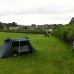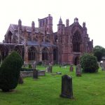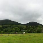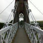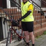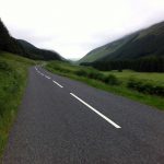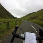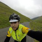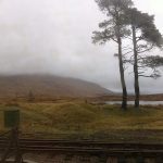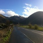
camping

Beyond the Dales we know and the Wigginton 300

29/04/17 and 13/05/17

Chalk and cheese in God’s own country.

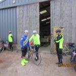
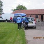
“Right, piss off”. And so around 40 riders were dispatched on what is hopefully the inaugural Beyond the Dales We Know 300 km. Some of us had arrived the night before and camped at Mike and family’s farm, which they had generously opened up to us as HQ. The finer details had not gone unnoticed, including the provision of a cockerel alarm clock to make sure we were all ready for the 6 am start.

Waiting for the start of Beyond the dales we know Waiting for the start of Beyond the dales we know

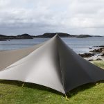
[These two photos have been nicked from Facebook and I can’t remember who took them, sorry. I just like that either I or my tent features].  I had entered a more tame ride (complete with Travelodge before and after) to be my first 300 km; but my plans had been thwarted, as is often the way, by life (in this case in the shape of a brick though my living room window), and so it was that I found myself approaching this ride – which would take us over some 3,500 m of climbing – with some apprehension.

Beyond the dales we know

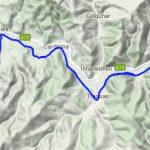
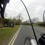
The route was pure genius, with flat sections at the start and finish and many lumps in between, over some of the best roads this part of the country has to offer. First we headed down to Ilkley, which was the nearest point to home for me, but I hadn’t been on these roads before. Next we turned north, passed Bolton Abbey and into the Dales National Park.

Beyond the dales we know

The Tour de Yorkshire was coming along some of these roads later in the day and there were lots of flags and painted bikes hanging out, however for some reason we didn’t receive any applause. The route turned up Littondale, and here was a section I recognised from a walk in the area a couple of years ago. I remembered that I’d always wanted to continue up this way, and here I was. A control at the Queen’s Head pub was a nice place to stop, just tea and crisps for me. I believe I missed a harmonica rendition. A few others were here around the same time; Andy and Rob (Rob doing his first 300 km too) and Steve? who’d started at 1 am from home that day on his way to yet another SR in a month.

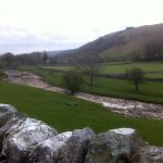
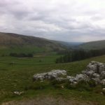
After this it got lumpy. The road up from Littendale over Pen-y-Ghent Gill to Stainforth is beautiful. A tough climb, so I was quite happy to stop for a photo half way up.

Beyond the dales we know Beyond the dales we know Beyond the dales we know

Then a gorgeous ride down to meet the ‘main drag’ towards Horton in Ribblesdale. The majority of the roads on this ride were deserted, so it was a bit of a shock to arrive in Horton which was full of cars and people and tents, there being a big three peaks race on over the weekend. I’ve walked them on separate occasions but have never felt the need to exert myself over such a prolonged time, through darkness, cold, rain, in a limited time…oh.

My right knee became painful at this point, and I began what turned out to be a prolonged period of doubting whether I’d finish, and general misery. The route passes close to train stations along the Settle – Carlisle line but after Dent (England’s highest station) bailout option are non-existent. Well maybe you could try hitching a lift at the Tebay truck stop. Such things occupied my mind for quite a long time.

After the bustle of Horton the road quietened down a bit before reaching Ribblehead, again also busy. A burger van was mentioned on the route sheet and provided much motivation at this point; I promised myself a stop here as bribery to continue. The fried egg roll was one of the nicest things I’ve ever eaten, in the way that just what you are craving is when you’ve been riding for hours. I saw a train leave the station heading south…the way home…no, keep going.

Now the road down through Dentdale is no doubt one of the ‘rewarding descents’ promised by Dean. Unfortunately I was at my most miserable here, my knee seemed to get better and I was fine for food, looking back I can’t quite explain it but I felt thoroughly unpleasant. I was conscious that if I was going to pack it had to be now, up the steep (of course) hill to Dent station. This is a beautiful place, but that was failing to make an impression. I thought about having to call Dean to tell him I’d quit, and would crawl sheepishly back tomorrow to reclaim my tent. I thought of how I’d feel instant relief now if I could stop, but that I knew I’d regret it later. My LEL dreams would be realised as a volunteer rather than a rider [thanks to Pete who later provided me with a kick up the arse by way of ‘I want to be stamping your card not having you stamp cards!’ I hope to be stamping in 2021]. I thought about that road along the Howgills on the east side of the M6 – when would I ever get the chance to ride it again?

At no point did my mind shift, I never thought ‘get over yourself and get on with it’; I just kept going and kept hating it.

Eventually I got to Sedburgh. On my previous two visits it was absolutely bucketing down so this was a nice change. As I prematurely took an ‘easy to miss’ turning Andy came out of a cafe and said a few of them were having a bite to eat, but I put my polite hat (helmet?) on and said “Thanks but if I stop now I’ll never get going again”.  Really I meant “don’t speak to me I hate you all why I am doing this”?  On finding the right road I followed Howgill Lane which, as the name suggests, is not an easy freewheel. At some point, and I’m not sure where, it stops becoming a green climb and turns into a moorland descent, full of sheep and grass in the middle of the road. About now and despite my best efforts I started to enjoy myself. I’d ridden up to JoG a few years previously and the route had taken me north up the other side of the M6. I’d loved it then, it’s a magical enough passage when driving or in the train, and being there by bike makes it even more ‘earned’. And now I was at the more remote side, dodging sheep.

Beyond the dales we know Beyond the dales we know

On arrival in Tebay truck services I was happy to see a few now-familiar faces. The cafe had recently closed but the shop was still open and the woman on the till was full of enthusiasm about our next roads, being a regular rider of them. This next section, from Tebay to Brough, was one if my favourites. Maybe I’d realised that although I might not ‘finish’ (be back at HQ in time) I wasn’t going to pack (really there aren’t any options) and so I relaxed a bit. I love riding over moors like this; very few (almost zero) cars, just snow poles and the unfenced road.

Beyond the dales we know

I reached Middleton-in-Teesdale still without full confidence and seeing the prospect of ‘hotel’ on a road sign I was again considering the options for stopping. Happily I followed the others in front and visited the Co-op, which offered no such distractions. Dean had asked that we report in at this point to give his crew in Staindrop an idea of their schedule. And the arrival there was wonderful! Cowbells, tea, and flapjacks. At this point with about 50 km to go, I must have realised I’d make it. I also knew there were at least a couple of riders behind me and some not too far in front, so I didn’t feel too out of it.

As I said the beauty (ok one of then) of this route is the flat start and finish. I was feeling pretty good, knowing I was on target to actually complete the ride. In the last few km I had a route sheet confusion and ended up on a dark road, somewhere near HQ. Reluctantly (as I don’t like to rely on it) I consulted the map on my phone and figured out how to get to the arrivée. The map is all well and good but the compass function is not to be trusted and as it turns out I was about to head off 180° in the wrong direction. Fortunately the local constabulary passed at this point and stopped to check I was ok. Since there is a police centre at Newby Wiske they were able to point me in the right direction. Eventually I rolled in as lanterne rougue, to the confusion of Rebecca and Co who I’d been ahead of at the last control. I’ve never finished a ride to a round of applause before! As lots of people were staying over there was a certain amount of beer consumption already in hand, and I was lucky enough that a can of Green King had remained intact. After enjoying that and a bit of a chat with the assembled company I retired to my tent and left them to several more hours of revelry.  The next day (Sunday) morning was bright and sunny, and a spontaneous breakfast was cooked up by Mike.  I felt not-too-bad, and rode the few miles back to Northallerton station for the train home to Leeds. The next day was a bank holiday and very fortunate too, by then the ride had caught up with me and I slept through the whole morning.


Two weeks later, having recovered both physically and mentally, I found myself in the surreal situation of lying in a village hall on a Friday night before the Wiggy 300 km with three other snorers riders, trying to sleep while bathed in the eternal dawn from an emergency exit light. My accommodation of Thermarest and sleeping bag seemed fairly luxurious compared to Raj next to me (a blanket) and a chap who’d retired to another room and was sleeping on whatever soft material he’d put his bike on in his car. Andy and Rob from Beyond the Dales were also staying over, and a couple in a camper van in the car park. I had my ear plugs but didn’t sleep particularly well, no doubt being conscious that we would be up at 4 am kept my brain active. All good LEL practice I told myself. It’s great being able to stay over before a ride, I don’t have a car so would have to find a B&B otherwise. Someone’s alarm went off but I’d already woken and got up, and was busying myself ejecting a slug which was attempting to take up residence in my panniers.

It was gloomy but dry as we left, and within the first half hour the sun broke free of the horizon, briefly visible as a huge red orb before being partially hidden by clouds. This route was quite unlike Beyond the Dales, being fairly flat in the main but with a final hilly section of 66 km. The routes shared a short section near Boroughbridge but otherwise explored very different landscapes. The first control was in a cafe in Malton, approaching which and passing Morrisons I realised I’d stopped here before…maybe on the one previous ride I’ve done from Wigginton. The cafe was a lot nicer than the supermarket, and I was happy to discover that I really can do 100 km before breakfast, powered only by a strong Brownian motion producer.

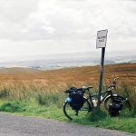
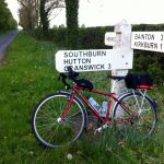
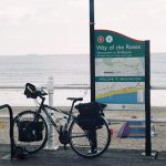
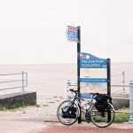
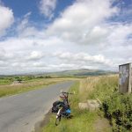
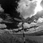
Bike and signpost near Hutton Cranswick Food after 100 km at Malton

Raj joined me and we discussed our onward travel plans, he found that his last train home was going to be relatively early and so pushed on as quickly as possible; my last one back to Leeds was after 11 pm which at an average riding speed of 20 kph should have been fine, but if not I’d ‘only’ have to wait 3 hours in York for the next service, which wouldn’t be the end of the world, so I was trying not to feel any time pressure. The next section was due west to Ripon, a place I remember from touring the Way of the Roses because I ended up riding round the centre in circles attempting to follow the NCN signs (a classic, where signs for the route point both left and right with no indication of which is the east and which the west direction).

After the first long stage the route was nicely divided into ~50 km sections which I found ideal. The next control was a cafe in the park which was shared with riders on the Wiggy 100 km. Raj and I left and rode together for the next section, north to Richmond. Here we tackled the climb up to the historic market town; a pilgrimage to Greggs where I explained to the person serving why she’d had a large number of requests for receipts. Here I chatted to another rider (Ossian as I now know) who was also preparing for LEL, this was only his third audax so I think he’s on track! We discovered we’d both registered for a 400 km from Mytholmroyd a fortnight later, a first for us both at that distance. Raj and I set off for Stokesley, the last control and the beginning of the scenic section. We chatted about our riding experience; Raj is from a costal part of India where he said you can do a 600 km without encountering any hills, but that meant a lot of experience of riding into the wind! He’s also worked and ridden in a variety of places including Canada and Singapore, so when I asked what he thought of British drivers he was very impressed with the consideration and respect experienced – which certainly puts things into perspective. On arrival in Stokesley around 5.40 pm we dropped into the control cafe but the proprietor said he could no longer offer us any food, as it was a Saturday evening and he was booked up, having expected us all earlier. He was however happy to sign our cards and fill water bottles, which was excellent and I explained that we were the slower end of the field. Raj set off as soon as he’d had his bottle filled, but I was happy (and needed) to take a longer break. There was a Co-op for sustenance and as it was now turning into quite a nice evening I had a wander around the town centre while eating.

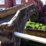
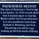
Packhorse Bridge in Stokesley Packhorse Bridge in Stokesley

Now the hills of the North York Moors that so far had been gradually approaching as grey silhouettes became real, with colours and shapes highlighted by the evening sunlight.

North York Moors

I hadn’t been around this area before, which may have been a good thing; I’ve found tackling hills in ignorance is often best! A few km after Stokesley we had a relatively steep drag, before an eye-streaming descent towards Chop Gate. The chap I’d spoken to in Richmond had left Stokesley just before me and mostly he was in sight, we were going about the same speed so it was nice to have company in that distant sort of way; experiencing the same roads but independent in our own little bubbles. It was now a cracking evening and for all looking at the elevation profile this was the section to dread it’s also (imho) the most beautiful and it was certainly my favourite.

Cyclist silhouette North York Moors, Bilsdale

On the next hard climb we caught up with Raj, and although I felt bad passing him I also needed to go at my own pace [edit: on LEL, which he finished and I didn’t, he commented that he’d learned to ride up hills since we first met on this ride].  Eventually arriving in Helmsley I recognised the centre having stayed in the youth hostel here a couple of years ago. A number of VC167 jerseys and their occupiers were taking a break in the town square. This leg was 66km and I thought I might need to take a break at some point, and my Greggs chocolate cookie was waiting in my rack bag if needed, but I pushed on. It got colder but I was just warm enough and reluctant to stop. As with every ride I found the last bit hard and felt like I was slowing, I don’t know if that’s real but it always drags. Beardy chap and two VC167 riders caught me up in the last 10 km and I managed to hang on to the back as they pushed fast for the Arrivée. I know I could never have put in that effort if I’d been riding alone. The two VCs (Denise and Les?) even put in a sprint finish. I was happy to be back, ahead of my guesstimate schedule of 10.30 pm, at about 9.15 pm, plenty of time to enjoy the copious tea and several species of cake on offer.

I thought I’d have plenty of time to get a train home but when I got to the centre of York (now full of Saturday night merrymakers) both road and pedestrian signs were useless; for a place with such famous rail heritage it would be nice if the train station was a bit easier to find. In the end I had to consult both a kebab seller and the map on my phone, and got to the station in time for the last couple of trains. The passengers consisted of a lot of drunk people; and me, dead to the world.  Some very loud blokes got on half way home, I could hear them between bouts of sleep and was vaguely aware that they were being pests but it was only when we arrived in Leeds that I realised they had entertained themselves by removing my bike from the storage space and bouncing up and down on it. I ended up with a lift home from the train driver (who cycles with a Wakefield club, what a star), and straightened my bike up the next week.


Two very different 300 km rides exploring Dales, Moors, Wolds and Hills. Yorkshire has a bit of everything (plus coast, to be experienced in my next ride…). I found the second ride more ‘achievable’ than the first (never say easy, it’s an audax); it was certainly flatter but I think a lot of this is psychological – I’d done a 300 km before so I could do one again. The first time, it was a new distance with all the uncertainty that goes with it. The second, perhaps I let myself relax and enjoy it a bit more as there was less pressure. Many thanks to Dean and Co for truly making an ‘event’ and not just a bike ride for my first 300 km, for me it really felt like an achievement and the atmosphere was wonderful. And to Keith and Ann – who provided constant tea and cake despite sporting a sling from a recent off – for a splendid tour over some lovely wrinkles and then through the Vale of York, before a sunny evening through the Moors.


Beyond the Dales: 300 km, 18 hrs 20

Wigginton: 300 km, 16 hrs 30


Yorkshire 300 routes


Port Navigation

01/04/17


I saw this event on the audax calendar some time ago when I was planning the year’s rides (with LEL training lurking in my mind). It was both on my 40th birthday and visited Mull, where I had a fantastic holiday a couple of years ago, so I couldn’t resist.  Clearly a long weekend would be required, and when I looked at train tickets an even longer one was needed to avoid the cyclists enemy, the rail replacement bus service.  If my LEL preparation had gone to plan I would have completed one if not two 200 kms by now, but life being what it is I only had my disastrous painful slog to go on.  But I had done one before, so I ‘knew’ I could do this.

Friday was spent travelling by train to Fort William.  Not the best of beginnings, as I had mis-remembered the time of my train from Leeds by half an hour and had to make use of my ‘contingency’ time; thinking that getting up at 5.30 am would allow me a leisurely preparation it became a case of having to forget about that second cup of tea.  It takes a long time in Leeds station to get up and down in the lifts so an early arrival is necessary.  Train one, Leeds – Edinburgh, was an old Virgin with those doors that need to be opened from the inside via the window, which although rather nice are also rather deadly and I thought had been outlawed some time ago.  Bikes in the ‘guard’s van’ which was also doing time as storage space for bottles of water, one of which was in the way of the bike rack and happily found its way into my thirsty pocket.  No problems unloading in Edinburgh and I had intentionally booked trains to allow plenty of time to change.  Then a short trip to Glasgow Queen Street for the connection to Fort William. There were a few other cyclists at Queen Street and I started to wonder how we’d all get on the train, but it turns out they have superior capacity with 6 bike spaces (per 2 carriages I think, certainly 6 to Fort William on this one).  I had an advance ticket and hence a booked seat, so I didn’t see the other cyclists once I’d sat down.  The journey north past Loch Lomond, on to Crianlarich and then across Ranoch Moor is splendid.  It was pretty wet but I did much more window-gazing than book reading.  There were lots of deer, mostly stags, not easy to spot as they are the same colour as the land.

Rannoch moor from the train Rannoch moor from the train Corrour from the train

Arriving in Fort William I did a decent amount of faffing but it still continued to rain as I left the station, which seemed rather a convoluted route through the nearby supermarket car park, and although I came straight out onto the A82 I was keen to make sure it was going in the right direction!  Riding out of town I was amazed at all the B&B and Guest House signs displaying ‘No Vacancies’ (how many people are riding this audax?), it was only much later that it occurred to me that they were still closed for the winter.  Not the nicest of roads as the traffic was quite fast, and it was raining quite a bit so just a case of head down and get on with it.  About half way the rain stopped and by the time I got to Ballachulish the sun was out.

Approaching Ballachullish

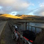
I spotted the turn-off that I’d need tomorrow to find the start, and the campsite I’d identified wasn’t much further on. Invercoe Campsite is open all year and the owners seemed very relaxed, I had to make a point of remembering to pay before I left.  Beautiful location and nice facilities.

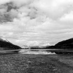
Loch Leven from Glencoe Village
Loch Leven
Loch Leven from Glencoe Village
Loch Leven

My parents were not letting me entirely ignore my birthday so had planned to come up from their home in Dumfries and Galloway in their camper van and visit.  Usually anything involving timings goes to pot but they surprised me by driving past my campsite (they were staying at a different one) just as I had started putting up my tent.  Once they’d installed themselves we had a few drinks in the Glencoe Gathering pub before a not-too-late night.

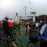
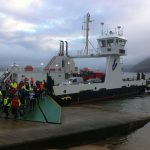
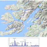
I was woken a few times in the night by rain, which was still falling on and off when I left for Ballachulish Village Hall.  The campsite had a shelter, intended for barbecuing when the weather has other plans, but the owner recommended it as somewhere to keep bikes overnight and when I went in to get mine I found a couple of other randonneurs having a fight with a stove in an attempt to cook pre-ride porridge.  I hadn’t brought any food or cooking stuff with me, and had spent the past three weeks mostly avoiding carbs, so this was to be a ride without relying on sugar and starch if all went to plan (although I had emergency jelly beans and gel in the rack bag).  I was at the hall in plenty of time and had a couple of cups of tea, before heading off in the first batch of riders dismissed by organiser Graeme.  This was a logistically complicated ride but it had been very well explained by Graeme, with ferry times for fast, medium and full value riders indicated, however we were all supposed to get the same first ferry, the 7.50 from Corran to Ardgour (mainland to mainland).  When I heard that we’d all (about 70 riders) fit on the one crossing I was surprised, but there was plenty of room and the ferry staff, who had been well-informed of our arrival, were excellent all through the ride.

Riders on the Corran ferry
Corran ferry
From the Corran ferry
Riders leaving the Corran Ferry

Somehow I managed to be first off the boat, but keeping out of the way to let the few motor vehicles off I ended up towards the back of the pack.  And there I was to remain!  Graeme had come over on the same ferry by car and passed us before heading to Lochaline to sign brevet cards at the first control.  On leaving Ardour we had the option of following the routesheet, which directed us via the more scenic route towards Strontian before quite a climb, or taking a flatter coast road which we were warned was of very poor quality.  I didn’t see anyone taking the second option.

Cyclist on Ardgour
Ardgour
Cycling on Ardgour
Ardgour

Having been warned of a ‘bastard hill’ I thought the first one wasn’t too bad, but I was soon to realise which was being referred to.   Once the road turned south-ish towards Lochaline it went up, and up, and up.

Looking towards Strontian
Highest point of the ride (272 m) and tough climb up to it

Eventually it must have started to go down but I don’t remember that quite so clearly.  I’d passed a couple of riders (unusual for me) but coming over the top and feeling a bit of rain (and not being very warm) I stopped to put my waterproof back on and they went by. Sometime around here I started thinking about the next ferry; I’d thought that I’d make the 10.35 am from Lochaline to Fishnish (Mull) based on my usual speed, but I could see it would be tight.  As it was the rear doors had just been raised and the boat started to move as I descended to the control…very frustrating.  But Graeme was there to not only stamp my card but impart relaxing words, and I was soon joined by Marcus, another rider.  It turned out that two people had made the early crossing, everyone else was on the one we’d just missed, and there would be two of us bringing up the rear for the remainder of the ride.  The folk running the cafe at the Lochaline ferry terminal were just getting their breath back after the onslaught of most of the field so I think were quite pleased that it was just the two of us now, and we had plenty of time to wait for the next boat.  I looked for a low carb something to eat so went for lentil soup, and a coffee, because I think I should need one at this point.  I had a marmite cheese that I’d brought along with me too.  It didn’t take long for me to start feeling sick, and there were moments when I thought I would suddenly reproduce the soup on the nice clean gravel outside the cafe, but it stayed down.


Once the 11.10 very arrived we were asked to board before the cars and put the bikes in a couple of wheel racks – goodness knows where everyone secured them on the previous boat.  We’d been instructed to buy a ‘hopscotch’ ticket onboard which would get us back to Oban later, at £5.60 this is the same price as a foot passenger.  Once on Mull I recognised the roads for a short time until we turned off for Salen.  I’m not very good at riding with other people and found I was going very sightly faster than Marcus, although he would catch me on descents, but after a while I had lost sight of him so I waited at a junction so we could continue together.  After Gruline the road clings to the coast and we were treated to some great clear views, although the wind was not exactly helping.

Shore of Loch na Keal, Mull
Shore of Loch na Keal

The Treshnish Isles were visible in the distance, some distinctive outlines which I recognised from my previous visit. The road then turned inland and we started playing hare and tortoise with a van full of birdwatchers for the next little while.  I lost sight of Marcus again but decided to press on and wait at the next control.  On the whole the descents on this ride were excellent, as the road ahead was in full view so no braking was required, but in this stretch a heavily pregnant cow and later some calves caused some cautious slowing down.  The road meets the shore of Loch Scridain and then the main A road.  Our control was at the Pennyghael Stores, and once again I recognise the road from my earlier bus journeys.  The shop had a very friendly ginger cat, as well as stickers to mark our passage and tea/coffee plus a roll which was included in our entry fee.  This is the sort of thing that I’d never ‘expect’ on a ride and is much appreciated.  As it was I just had the tea, and feeling better had some nuts and a bit of cheese.

Pennylghael stores, Mull
Pennyghael stores
Loch Scridain by Pennylghael, Mull
Loch Scridain near Pennyghael

I had previously travelled the whole of the next section to Craignure by bus, during which gradients are of course less noticeable, but the climb up Glen More was a pleasant one in the continuing sun.  I passed the lochs that I’d walked along on my previous visit and then Loch Spelve where I’d waited (quite happily) two hours for a bus.  I arrived at Craignure a little before Marcus, we’d both realised at the previous control that there was no chance we’d make the previous ferry so it had been a fairly relaxed leg and we had a bit of time for a cup of tea from the shop.  The ferry staff asked how many more of us were expected (none) and commented on how many riders had been on the last crossing.  We were entertained by watching the ferry approach, trying to work out which end was going to open and being amused by the technique of making contact with the jetty and using it to pivot around to line up with the landing stage.  There was a section for bikes in the centre of the vehicle deck, again I wondered where they had fitted everyone in on the previous crossing.  Marcus and I went upstairs for a comfy seat and discussed how we’d got into Audax, followed by discovering we have a few colleagues in common.

Craignure ferry, Mull
Craignure ferry

Back on the mainland in Oban and we knew we had 60 km to do in x hours, which was achievable for us both although we couldn’t hang about.  Out from Oban the route follows a road to a car park and then an odd section of cycle path to rejoin the A85.  The cycle path had the most crazy steep sections, including the final bit where a boy who saw us struggling opened the gate to let us through.  The final crossing of the day took us on Connel bridge over Loch Etive, then all the way along the side of Loch Creran to answer an info control.

Head of Loch Creran
Head of Loch Creran

Soon it began to get dark, and it was just a case of head down and keep riding. Sometimes I’d pass Marcus on a climb and then he’d catch me, eventually I pulled ahead but could see him not far off when the road allowed.  At last I arrived at the road works outside Ballachulish centre, and I thought Marcus would catch up while I waited at the red light, it would have been nice to finish together, but I rolled into the hall complete with fairy lights at 9.xx pm.  Marcus eventually arrived with literally minutes to spare, having had to stop for cramp near the end.  Graeme and crew fed us, I had some soup but still felt nauseous so didn’t risk the cake.  My parents who turned up to wish me happy birthday were generously looked after, and we celebrated properly the next day.

Loch Leven from Glencoe Village
Loch Leven
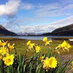
Daffodils by Loch Leven
Loch Leven

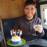
Birthday cake and champagne

At Glencoe visitor centre

An early start on Monday morning to catch the first train back home and another fantastic journey for window-gazing.  A different route home taking the Carlisle – Settle line which had just reopened a couple of days before.

Deer running from the train, Rannoch Moor
Deer running from the train
Railway between Bridge of Orchy and Tyndrum
Railway following the contours between Bridge of Orchy and Tyndrum
Garsdale station
Garsdale station

Route of Port Navigation 200 km ride

200 km, 13 hrs 50 mins

The Way of the Roses

Bridlington WotR start Morecambe WotR end
29/08/16 – Bridlington to Pocklington

It was the day that everyone went home from Leeds festival, so the train station was covered in mud and smelled stale.  Unfortunately a few folk were on my train to Hull and brought the aroma with them.  Second train to Bridlington was ok but full of beach-goers including a small child singing that song from ‘Frozen’.

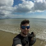
Arrived in Bridlington 11.30 am and went to the North Sands where the route starts.  It was busy, the weather was excellent.  Had a quick paddle in the sea; I’d rather dip my feet than my corrodible wheels.
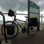
Bridlington WotR start Paddling in Bridlington

The route left town up a little bit of a hill which would have been ok apart from the cars which mostly couldn’t be bothered to wait until the next passing place.  Past a Norman manor house at Burton Agnes followed by the first of many level crossings (counted eight over the course of the day).  These were either with lights and a barrier, or just a gate when on roads marked as dead-ends.  One had a kissing-gate which was just too small for my loaded, yet conventional, bike.  Anything more exotic would have struggled.  Signing however was excellent, most unusual for NCN routes; a few of the usual daft ways of crossing main roads but great on the whole.

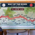
Through Nafferton (‘posh’ says my notebook) and to Driffield, where I stopped for (my own) food.  The route doesn’t go through the town centre so I don’t know what it is like.  Apart from the hills out of Bridlington it is fairly flat, with lots of arable farmland, wheat/barley and grass, and some tall reed-like things wth no clear edible part.  Leaving Driffield the route crosses the railway line three times in such quick succession that two of them are barely distinguishable on the map.  Past Skerne and on to Hutton Cranswick to cross an A road.  Just after this was a sign for a garden centre/cafe, and although my plan was to avoid too much cake I was flagging so stopped off to refuel.  They had a huge WotR map and I could see that the day’s ascent was about to start.
Towards Bridlington WotR route in coffee shop

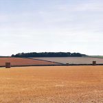
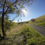
Just before the hills was probably the route’s flattest section, with lots of drainage channels and a road taking 90° turns, reminiscent of the roads around Glastonbury.  Then the climbing started, towards Tibthorpe, but it wasn’t too steep at any point, mostly a long slow drag.   After Huggate I thought it was all downhill but there was a little more climbing, then a sudden turning which went downhill through an amazing valley (river long since gone), with little tributary valleys.  This was a stark contrast to the flat fields, a little wrinkle in the smooth land.
Flat Yorkshire fields Flat Yorkshire fields Yorkshire Wolds Yorkshire Wolds

The route was downhill until a double switch-back where it left the first valley and headed to Millington.  I had marked a couple of campsites here from the WotR website but saw no sign of them.  I kept going, the route climbing up the other side of the valley which had me off and walking at one point.  At the top I met an old chap with a bike sitting on a bench, so I asked if he knew of any campsites.  “Campsites…(long pause)…campsites eh?”  Proper Yorkshireman.  After some further thought he gave me very helpful directions to a caravan site in Pocklington; always wary of places that don’t take tents but I saw a sign with a tent symbol on so became more optimistic.  Reception was closed but I rang their bell and a very friendly woman came over, directing me to a nice pitch.  Excellent site, mostly caravans; South Lea Caravan Park.  Very clean toilet block, flat stone-free ground with short grass, £10.  It was next to a busy-ish road so a little noisy.
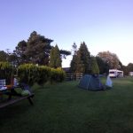
At South Lea Caravan site

Roadkill of the day: stoat.

45 miles, average 9.9 mph


30/08/16 – Pocklington to Ripon

Left the campsite about 10 am which is acceptable for early days of a tour!  There’d been a heavy dew overnight but it was a sunny morning.  All flat to Stamford Bridge, where the route goes off-road on an old railway line path; the station building is still there and seemed to be used as a community centre.  After crossing the River Derwent the route runs along the A 466 briefly then turns along a road marked dead end/private estate.  Reaching a farm it becomes a bridleway and crosses a few fields; a wide track but bumpy in places, I’m sure it would be muddy if wet.
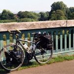
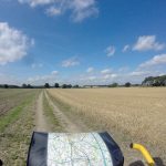
Bike in Stamford Bridge Bike and bridleway over field

Road again at Dunnington then the route negotiates its way across a few A roads before passing through Oswaldwick.  The village has a stream running between the road and houses so lots of people have a little bridge in front of their houses.  Also lots of new building going on, huge houses by the looks of it.  More cycle path before crossing York’s inner ring road and arriving at the Minster.  Signs all good here, it was of course very busy and I found it difficult to find a bike parking space.  Eventually I found a space on a rack on a side street which involved having to climb over an adjacent stead to get out after locking up.  Got a tubigrip for my wrist in Boots; I thought I’d struggle with the reduced strength in my hand but rather it seemed to be vibrations in my wrist that were most uncomfortable and this was a great help.  An ice-blended coffee and a seat in the shade were much appreciated at this point.

York Minster

Now noticing the discomfort on returning to the saddle I headed out of the centre on a route that I recognised as I’d stayed on the same street for work last year; which was fortunate as there was no sign, but I remembered the way to the river.  A stupid example of a cycle route here included a step and much zig-zagging to get onto the cycle path.  Once there however this was traffic-free, quite a few other cyclists and pedestrians.  A wide area of grassland (Clifton Ings) reminded me of Oxford.  Then the route rejoins the road, under then over the railway to touch an A road near Shipton.  Then on to Newton-on-Ouse, another expensive-looking village.  I stopped on the green to eat and tried to work out the time by the sundial, which looked like 2.30 pm but the local church chose that moment to ring a single chime.
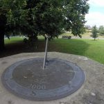
sundial

Through Linton where there is an RAF base, the planes looked old to my ignorant eye, not the fast jets I associate with military use.  The route then crosses Aldwark bridge which has a toll, although bicycles are free.  It did seem rather rickety.  Happily my crossing coincided with that of a vintage camper van which suited the scene, the driver chatted to the toll keeper and it sounded like an annual gathering was just dispersing.
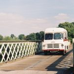
Toll bridge

Shortly after I was passed by some cyclists I had seen having a break by the bridge; a tandem complete with small dog in a rear basket and a friend drafting them.  Approaching Boroughbridge I saw a farm selling eggs and apples (Discovery), bags of six apples were £1 but I had no need of so many so I took one and left 20 p.  An early first apple of the year.  On the way out of Boroughbridge are some impressive standing stones, two in a field and one by the road with some information.

Then the route goes under the M1 (I made a note that junction 48 is the nearest for next time I’m driving and bored) before entering Ripon. I stopped at the cathedral before looking closely at the map, and realised the campsite marked would involve a little back-tracking.  It was not very well signed and required an unpleasant crossing of a dual carriageway roundabout.  Lockside Caravan Park is a small site, near the race course the commentary from which was still going at 7.30 pm.  Fairly basic but decent condition, £6 plus 50p for a shower.

52 miles, average 9.9 mph


31/08/16 – Ripon to Grassington

Another 10 am start, there was a brief shower just before I packed up, and it was sunshine and showers all day.  I was lucky and avoided most of the rain, only needing the waterproof for one downhill section to keep warm.  I returned to Ripon Cathedral after passing it yesterday to get back on the route.  After going around the central streets I came to a junction with WotR signs pointing both left and right, with no indication which was the east and which the west route.  I followed the ones pointing in the direction I was headed based on the town names…which was wrong as I ended up back at the Cathedral.  Back to the sign and I took the other option.
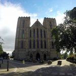
Ripon Cathedral Ripon Cathedral Ripon Cathedral

On to Studley Roger and in through the grand entrance to the National Trust Water Gardens/Fountains Abbey estate.  Up following a ‘no cars’ lane, past a little church and out onto another road.  No real sight of the Abbey but I have visited before.  Then passed a car park which I recognised from that visit before continuing along lumpy roads – I was finding the hills here hard work, like Cornwall where they are steep up and down all the time.  Quite a headwind all day too.

I had a brief stop at Brimham Rocks for dried fruit, definitely in need of sugar by this point, then fortunately mostly downhill through Glasshouses and into Pateley Bridge.  I covered the laundry drying on my rear rack as the clouds looked dark, and visited a nice tea shop on the downhill section of the main street.  Crazy location for a town, such a steep valley.  On leaving I was confronted by a very steep B road out of town which I had to walk up.  It was marked as 16 % and it just seemed to go on and on.  There were road signs at the top and bottom warning of slow cyclists but it was still hairy going, lots of bends so hard to stay visible to traffic (which would have been much different if I had be riding).  Somewhere around Greenhow it levelled out a bit, clearly high up with great views of Nidderdale north and south.
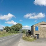
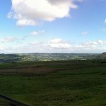
Pateley Bridge Nidderdale

Of course the wind was stronger on top.  I stopped at Stumps Cross Caverns, just for an ice cream  but I’d like to come and visit the caves sometime.  I hadn’t covered many miles so far so back on the bike into a strong headwind and a bit of rain, though at least mainly down hill to Appletreewick.  Then through Craven Arms (‘Gateway to the Ales’ – very tempted to stop here especially as there was a nice looking campsite) and I recognised a pub from an audax which went in the opposite direction along this section.  On through Burnsall which looked like a nice place.
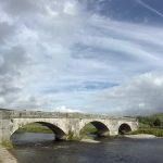
Burnsall

Shortly afterwards I decided to leave the route and continue on the B6160 to Grassington, thinking there was more hope of finding a campsite around the town.  I did starting looking at bus shelters on the way… A steep climb with a bit of walking up to the town centre and I spotted a hillwalking shop so went in and asked about campsites.  The guy in the shop said there was one near Threshfield which was the closest and gave helpful directions.  Still tired so I stopped for a can of coke and white bread sandwich from the local spar (sugar required, not my usual cuisine at all), plenty of nice cafes/pubs for the less messy/fragrant visitor.

I found the campsite (near Skirethorns), I do wish they were signposted from further away though.  It was a very small place at the back of a farm, basic but functional, £6. There were two other tents there when I arrived, one small with a couple plus little dog having a BBQ, and the other a large tent with a couple who were playing Rick Astley and taking loudly.  Later they watched Emmerdale and Corrie and had a row.  I pondered the consequences of cutting the cable to their satellite dish.

34 miles, average 7.5 mph


01/09/16 – Grassington to High Bentham

It felt like September this morning, I could see my breath and had to put my jumper on.  I got up a bit earlier and left around 9 am, hoping that my clattering woke the TV watchers.  A sunny/cloudy day, the wind was not too strong but again blowing in an unhelpful direction.  I left Threshfield and took the B road to Cracoe to rejoin the WotR route, which then goes to Aireton via Hetton and Winterburn, which was lumpy but no walking required.  The next section over Scosthrop Moor involved more up, although it was a long slow climb so also all ridable with good views from the top.
Scosthrop Moor Scosthrop Moor Scosthrop Moor

There was a steep decent into Settle, where I stopped at Ye Olde Naked Man cafe, chosen on the basis of the name but recommended for quality also.  Their benches outside seem to double as a bus stop which explained the sudden appearance of a number of folk of advanced years while I was inside ordering.

Cafe in Settle

Then I went into the tourist information centre to see if I could find a campsite that I could get to at 4 – 5 pm, probably near Gressingham.  It was staffed by classic National Trust-style old lady volunteers, who were lovely but despite their best efforts devoid of knowledge.  This took quite some time while one of them (who lived in Bentham) wracked her brains, and was also interrupted by another visitor looking for their wi-fi, at which point the other read out/showed him the instructions that she had which clearly could have been written in arabic for all they made any sense to her.  He managed anyway.  When eventually ready to leave I found I couldn’t get my bar bag to clip in to the holder, and after much faffing realised that the angle of the holder must have changed slightly so that the gear and brake cables were now in the way.  There was another chap with luggage (not quite as much) fixing a puncture, he seemed only to have one tyre lever so I lent him another.

Having stopped for way too long I wondered where to aim for for the night, and planned to see how things were going when I got near Bentham where I was reasonably confident of a campsite.  The route leaves Settle and heads up Ribblesdale, on presumably the more undulating side than the B road and railway line follow.
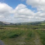
Ribblesdale

Then it heads west to Austwick before meeting the A65 where a short section of cycle path has been reclaimed from a field.  Then up to Clapham, yet another nice village.  It was tempting to stay on the B6480 straight to Bentham but felt like cheating to take the easier option. There was an underpass under the A road shared with a stream, and then the roads leads to Clapham Station.
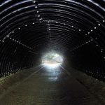
Underpass

There was a steep section after this which required a bit of walking, up to a crossroads at Neasden which offered nice views towards Ingleborough then along the south side of the Bentham valley.
Keasden crossroads Keasden crossroads Keasden crossroads Ingleborough

By now I’d decided that aiming for Morecambe was over-optimistic and liable to end in my arriving late so thought High Bentham a good bet for finding a campsite.  Initially I couldn’t see any sign of the site which was marked on the map, but I stopped in the village which had a sort of tourist information place which was a tiny room at the front entrance to the town hall.  Although closed you could still get in and I found a list of local campsites; two annoyingly back towards Clapham but they at least confirmed that they accepted tents whereas several others appeared to be caravans only.  Happily the first, Curlew Camping, was open.  It’s a small holding, with chickens and a few sheep, run by a slightly odd but very nice chap wearing a grubby ‘caving rescue’ t-shirt (and a couple of caving dry suits hanging up by the stable).  One toilet and shower in a small room attached to the side of the house, covered in notices and posters, very characterful.  £6 or £7 with car.  Views south towards the Forest of Bowland; north Ingleborough and Whernside would be visible from slightly higher.

A hen came to see me as soon as I’d arrived, she’s obviously learned that campers = food and I gave her a bit of oatcake, although she would peck anything that had potential (clothes pegs, hands, etc) and was quite happy to stand on my bare foot to get closer.  One other camper, also a cyclist who was driving up north but having a few stop offs on the way.
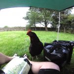
hen

31 miles, average 8.3 mph


02/09/16 – High Bentham to Morecambe

It was quite a wild night with wind and rain, and I wished I had put the extra guy ropes on but there was no water ingress and happily the rain had stopped by morning.  I left about 8.30 am and followed the B road back through High Bentham and on to Low Bentham and Wennington to Wray where I rejoined the WotR route.  Wennington was the first place in Lancashire but sadly there was no welcoming sign to photograph.  The route signage was not quite as good once over the border and I was glad to have the map on a small stretch of A road through Hornby.  Then over the River Lune to Gressingham.  Lumpy (no walking required) roads over the north side of the Lune valley until eventually down hill (for good this time) through Halton Park, where there was no grand house visible but the grounds were ‘kept’ with short grass and mature trees.  I had a stop at Crook of Lune, a sharp bend in the river, where there was a little cafe (Woodies) where I had a coffee in a proper mug and tiffin from yesterday’s cafe in Settle – always stay one snack ahead!
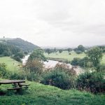
Lune Valley Crook of Lune

From here the route followed the Lune to Lancaster and was traffic free all the way to Morecambe, so easy going.  It’s old railway line, a very good shared route (apart from when a group of MAMILs came the other way like they owned it).  I stopped to check out an aqueduct where the Lancaster Canal crosses the river.
Near Halton Under the M6 Lancaster Canal/River Lune aqueduct

You don’t see much of Lancaster although I’m sure it would be easy to stop off and explore the city.  Crossing the river in Lancaster the signs were confusing and I ended up on a three-lane A road rather than the intended shared-use bridge.  Back on track to Morecambe and the traffic free route continues with frequent signed turn-offs to bits of town – great if you live here I imagine.  More confusing signs on reaching the end of the path around the train station, so I just followed the road signs for the promenade and found the official end (start) of the WotR route.  I had a paddle in the sea then a cruise up and down the promenade which is nice and wide, shared pedestrian/cycle/horse and cart use.

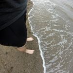
Morecambe WotR end Paddling, Morecambe Paddling, Morecambe

Sea at Morecambe Morecambe WotR end

The town seemed a bit of a dump, a main feature being a large tower sponsored by Polo.  I couldn’t even find a Weatherspoons for a celebratory pint and wi-fi so went to the train station.  The direct trains to Leeds are few but there was one due half an hour later so I headed home.  Finishing had been a bit of an anticlimax, probably because this was such an easy final day, and I had taken a day longer than I’d hoped.  The trip was a bit of a last minute decision, if I’d had more time I’d have planned my campsites better and probably completed it in four days.  Of course it has been done within 24 hours…although with less luggage.

23 miles, average 9.4 mph
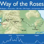
 

WotR map

Isle of Mull

27/08/15 – 04/09/15

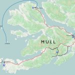
Isle of Mull map


Craignure

Train to Oban via Glasgow (note the change in cuisine).  Ferry to Craignure and a night at the campsite there.  A nice spot with great clean facilities, including a common room with wood-burning stove.
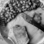
Haggis crisps Sound of Mull Sound of Mull Craignure campsite


Tobermory

The bus services on Mull are great, and the Craignure – Tobermory route uses a double decker so you can get a great view.  The majority of the roads are single track with passing places, so it’s a nice slow journey.  Spent some time watching gannets diving into the sea while waiting at the bus stop.  I was told that the ones around here nest on St Kilda; that’s 140 miles as the gannet flies, a long way for a fish supper.

Tobermory Tobermory harbour Tobermory harbour Tobermory harbour Tobermory harbour


Rainy day activities: distillery and museum.

Rain drops on tent Tobermory whisky fast river Peaty water


A boat trip to Staffa via the Treshnish Isles, featuring a white-tailed eagle, gannets, kittiwakes, shags, seals, a minke whale and maybe some porpoises.  And exciting rocks, of course.  Very smart boat and knowledgable crew from Staffa Tours, happy to spend time detouring to follow the minke.

Rubha nan Gall, Mull Treshnish Isles Seals, Treshnish Isles Seals, Treshnish Isles Staffa Staffa Fingal's cave Fingal's cave Fingal's cave Fingal's cave Staffa Staffa Staffa


Fionnphort

Amazing campsite at Fidden farm, right above the beach.  The sun came out and the sea was irresistible.  And freezing, obviously.

Fiden Farm, Mull Fiden Farm, Mull Fiden Farm, Mull Shells Shells Swimming, Mull Swimming, Mull Erraid from Fiden Farm, Mull Fiden Farm, Mull Fiden Farm, Mull


Moonrise and sunset.

Moon landscape, Mull Fiden Farm, Mull


Views from Fionnphort.  The strange shaped island beyond Iona is The Dutchman’s Cap, one of the Treshnish Isles.  The others were named by Vikings, not contraceptives.

Fionnphort, Isle of Mull Fionnphort, Isle of Mull Sound of Iona


The tidal island of Erraid as featured in Robert Louis Stevenson’s Kidnapped.

Erraid, Mull


Iona

First stop the nunnery.  A carving over a window shows a voluptuous and accommoddating woman, apparently keeping those inside safe from such temptations.  One tiny room of the whole complex had heating – they must have been some tough nuns.  Today was very sunny (i.e. I got burned) but required all layers and a hat because of the wind, and that was the tail end of summer.

 Iona nunnery Iona nunnery Iona nunnery


The Abbey; journey’s end for many, be they pilgrims, coach trippers or important dead people.  In front of the abbey in the grass is the Street of the Dead (Sràid nam Marbh), after it passes the burial area (Rèilig Odhrain).  There is an exhibition of ancient stone crosses, where I learnt that the circle was an addition to support the lateral arms which could otherwise be heavy enough to cause the stone to break.

Iona abbey Iona gravestone Iona gravestone Iona abbey Iona abbey Iona abbey Iona abbey Iona abbey Iona abbey Iona abbey Iona abbey Sound of Iona


Views from Dun I, the highest point on the island (101 m, so just a HuMP).  Excellent visibility, Cullins of Skye spotted.

Sound of Iona View from Dun I, Iona


There is a green colour in the rocks found in abundance in St Columba’s bay, apparently from chlorophyll.  I should have brought my accommodation with me, it would have been a lovely spot for the night.

Beach on Iona St Columba's bay


The three lochs

A short-ish but tussocky and boggy walk followed by a very wild camp.  Nice evening with ever-increasing wind.  Met an adder shortly before pitching for the night on the only vaguely suitable ground.  Previous choice was under a sheltered rock, but a deer had obviously had the same thought when it was unwell and consequently expired there.

Glen More, Mull Glen More, Mull Loch Àirde Glais Gleann a' Chaiginn Mhòir, Mull Adder, Mull

A peg was blown out into the burn at 5 am, so that corner of the tent was anchored with the water bottle and I waited in the sleeping bag for enough light to pack up and walk down towards Loch Buie.  I serendipitously found the peg while rinsing out my mug before I left.  Walking to the main road I missed the bus by a minute or so, the next one was two hours later so I sat by a sort of estuary where the river Lussa enters (the sea) Loch Spelve, watched the birds and had tomato soup.  I think I spotted an eagle.

Lochbuie, Mull Loch Uisg, Mull Kinlochspelve, Mull

Balure cemetery, Loch Spelve, Mull Hills on the mainland from Mull Soup on the shores of Loch Spelve Route of three lochs walk, Mull


Oban

Back to reality…the first establishment encountered on disembarking from the ferry in Oban is a Weatherspoons.  But the place did have some more individual touches.

So long and thanks for all the fish; Oban

Wales 2015

04/07/015 Holyhead − Bangor

Arrived at Bangor station around 3.30 pm, rode to the marina area to try and find the official start of NCN 8; nothing obvious, just a few bike signs with something else on them.  Tried to get a sandwich in a pub but they had stopped serving 10 minutes previously.  Several cafes closed, found one still open but which had also stopped doing food, so settled for coffee and a sandwich from the Co-op.

Holyhead, start of NCN 8

Stuck to the A5 rather than try and follow NCN 8/5 here; with the A55 running parallel it was pretty quiet.  Good weather, fairly flat and a light wind.  There was a nice path/cycle track over the causeway from Holy Island, the tide rushing through a channel in what looked otherwise solid.

Milestone on Anglesey Menai Bridge Camping dinner Bangor

Over the Menai Bridge, which is quite narrow so difficult for cars to overtake but it’s not very long.  The campsite at Treborth Farm was just over the bridge, nice place but quite expensive at £16 plus £1 for the shower.  Not a quiet evening, first some nocturnal activities from a couple in a nearby tent who had perhaps overestimated the sound proof properties of nylon, then fireworks (independence day?).

Holyhead - Bangor map

24 miles


05/07/15 Bangor − Porthmadog

Weather good and ready to leave at 9 am, at which point there was a sudden downpour.  It seemed like an odd shower until later when the rain set in properly.  Followed route 8 signs on and off to Caernarfon, the usual daftness of avoiding the road in places, although useful to find my way out of Caernarfon, my coffee and bara brith stop.

Welsh flags in Caernarfon Caernarfon Caernarfon

Going south the route goes off-road, following a narrow gauge railway.  There were a few groups of blokes working on the line including some around a very rusty old engine.  It looks like the line goes all the way to Porthmadog but goes east inland at Dinas whereas the cycle path continues south along what looks like another old train route, a very nice section.

Cycle path NCN 8 Welsh railway Welsh railway Welsh railway 

The ride became a bit of a drag, into the wind and the sort of gradient that you can’t tell if it’s up or down, and then the rain started.  The route joins the ‘road’ – which is a very steep concrete section with lateral lumps in, through a farm.  I had already planned to divert to the more sensible B road here, which I followed to Criccieth.  I found a great tea room with a waitress sympathetic to my dripping.  Welsh very widely spoken here.

Cycle path and rain Rain approaching Criccieth

Stuck to the main road to Porthmadog as it was still unpleasant, and found the campsite at Tyddyn Llwyn fairly early.  A big place equipped with very welcome tumble driers, and a pub/restaurant on site.  Mostly static caravans, and my only complaint was that the tent pitches were not on very flat areas.

Campsite Porthmadog Bangor - Porthmadog map

32 miles


06/07/15 Porthmadog − Dolgellau

Rained all day.  As advised the bridge from Minffordd to Clifor was closed (due to reopen the following week) so I took the detour up the Vale of Ffestiniog to Maentwrog and back down the other side.  There were road works with traffic lights on the return section and it was only when I got to Clifor that I realised how long they were, and that a large queue of traffic had been at waiting for me to pass.  Good job I didn’t stop to take photos.

NCN route 8  Vale of Ffestiniog

I decided to stick to the A496 rather than the 20 % gradient on offer on route 8, a B road to Harlech.  This turned out to be an excellent choice as most of Harlech is high up and this was a more gradual way to approach it.  I stopped for allegedly one of the best scones in town (no complaints) while successfully struggling to resist a full ploughman’s.  Seemed quite a well-to-do place, and a UNESCO heritage site.  Some building work around the castle looked like a new bridge for visitors.

Harlech castle

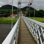
Continuing along the A road to Llanaber I rejoined NCN 8 where a very steep path takes cyclists and walkers down and along the promenade to Barmouth.  Over the Mawddach is a bridge for trains with a board walk for bikes and pedestrians; there was a closed toll office and a few weeks after returning home I saw (and signed) a petition to the local council to keep the bridge open to cyclists.

Llanaber Llanaber promenade Barmouth bridge toll office Barmouth bridge toll office Barmouth bridge

Once over I failed to find route 8 for a while, at last it appeared by the road at Penmaenpool and I followed it to Dolgellau.  Cooked under the tent’s porch in the rain and changing wind.

Trangia porthmadog - dolgellau map

39 miles


07/07/15 Dolgellau − Machynlleth

A nice quiet road out of Dolgellau winds uphill before crossing the A road of the Bwlch Llyn Bach and then heads straight up what is not much more than a farm track; a long walk pushing a loaded bike.  I met a few D of E-ers coming the other way, complaining about their walk and wishing they had wheels.

NCN 8 near Dolgellau NCN 8 near Dolgellau NCN 8 near Dolgellau NCN 8 near Dolgellau

At the top was an almost alpine view of the valley down to Aberllefenni, and I could get back in the saddle.  Some slate mines in the very steep hillsides just before joining the road to Corris, where I stopped in a very busy little shop/cafe.

NCN 8 to Aberllefenni NCN 8 to Aberllefenni Slate mine near Aberllefenni Corris train station

Although the weather had been much better today I stopped fairly early in Machynlleth.  This was the last place with a train station along route 8, and if I went further I was committed more or less all the way to Cardiff.  I had a train booked but no contingency time, and aware that the longer and hillier days of the route were still to come I decided to stop here for a few nights and return home via Manchester.

NCN 8 near Machynlleth Campsite near Machynlleth Campsite near Machynlleth

I camped at a site near the Centre for Alternative Technology, a couple of miles north of town.  There was no hot water when I arrived but I think that was the fault of the large D of E group that had arrived before me.  It was very windy and the lads group kept having to chase after various bits and pieces to stop them being blown into the river (Dulas) that ran past the campsite.  My tent, once up, survived the wind and the rain that passed in the night very well.  There was another cyclist called Anna also doing route 8, including a detour to Hereford for a party.  She seemed to be travelling fairly light, no front panniers, so I’m not sure where she had secreted her party togs.

Dolgellau - Machynlleth map

15 miles


08/07/15 Centre for Alternative Technology

Centre for Alternative Technology Centre for Alternative Technology Centre for Alternative Technology Centre for Alternative Technology Centre for Alternative Technology


09/07/15 Aberystwyth and Borth Sands

Visted the Dyfi Osprey Project, with great timing as the young were expected to fledge in a week or two.  They have four cameras for great views of the nest and perch, plus a huge hide with telescopes and binoculars, and very enthusiastic and informed staff/volunteers.  The reserve is boggy wetland area, and they keep two water buffallo to help manage it, a strange sight in mid-Wales.  Plenty of other birds around (redpolls and siskins plus the usual tits), dragon flies and a bank vole (identified as such by being tiny).

Dyfi Osprey Project Dyfi Osprey Project Dyfi Osprey Project Water buffalo, Dyfi Bank vole, Dyfi

Had quite a chat with one of the volunteers who turned out to be from Cupar, and also worked with Sustrans.  He didn’t think that cycle provision was very good in the area, so I didn’t have to pretend to be polite – some of route 8 is great but as usual some is daft and the signage is poor.  Another chap was looking at my bike while I was in the gents, he had been quite a serious rider in his younger days but was now looking for a more comfortable machine.  He asked me technical questions about gear ratios so I smiled and nodded.

I cycled further along the Dyfi to the coast and the huge dunes at Borth sands, then up a crazy hill (25 %, the road is visible in the photo) and down the other side to Aberystwyth.

Borth sands Borth sands Borth sands South from Borth sands

Spotted a pair of dolphins in the bay and watched them for a while, getting sunburned in the process even though it was after 6 pm.  The train back to Machynlleth.

Aberystwyth Rocks, Aberystwyth Dolphins off Aberystwyth

Machynlleth - Aberystwyth map

23 miles


10/07/15 Machynlleth

While waiting for the train to Manchester I attempted to visit the local gallery, but most of it was closed as they were hanging a new exhibition.  There were some photographs of birds on display which were good, and I visited the cafe and eavesdropped on some posh ancient locals, who were rather amusing.  Then a mooch around the graveyard, which had a huge range of stones from worn slate slabs with barely any visible writing, to large monuments in the more well-to-do area.

Post box in Machynlleth Machynlleth Red Kite

Grave stone in Machynlleth Grave stone in Machynlleth Grave stone in Machynlleth Grave stone in Machynlleth