21/03/26
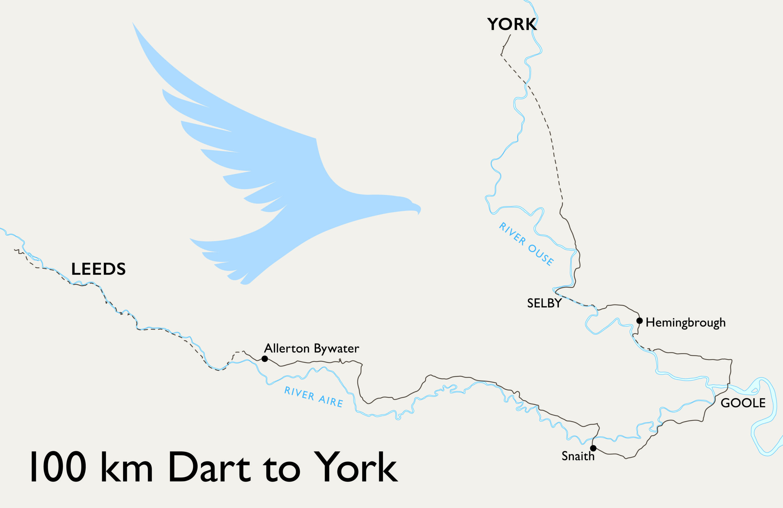
Audax UK is 50 this year and held its annual reunion in York. Being close and a significant birthday it seemed rude not to go. I found a route from home that would take the distance up to 100 km, by more or less following the river Aire to Goole, then the Ouse up to York, and registered it as a Dart with splendid organiser Lucy MacTaggart. This is essentially a DIY and I went with the ‘by gpx’ method, both a first for me.
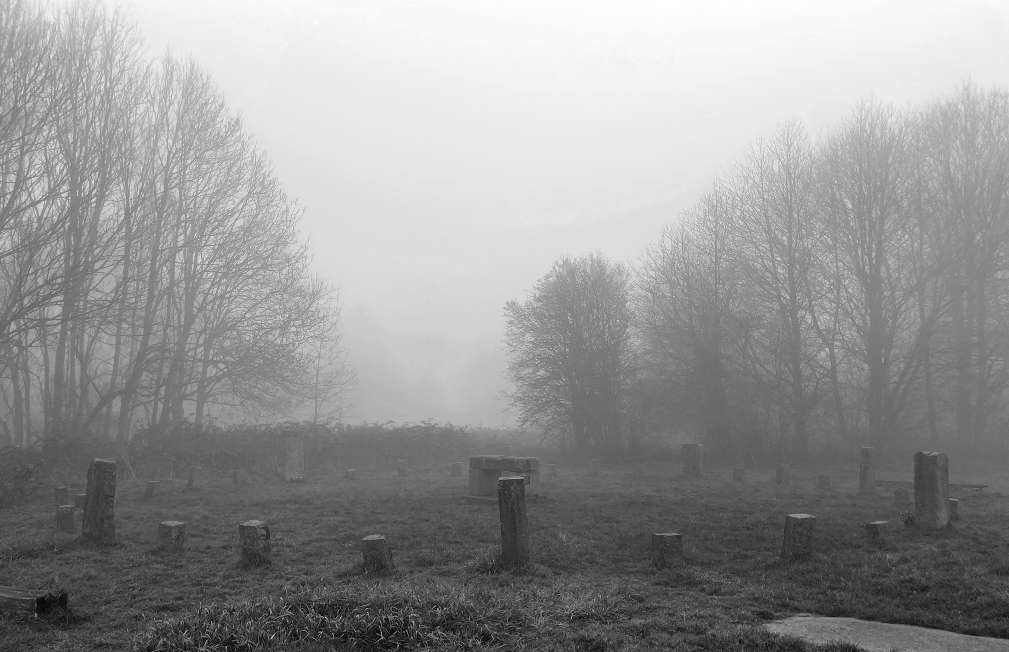
The forecast a couple of days before was for sun, but it turned out to be a very damp morning of thick mist when I left home around 7 am. I am a bit out of practice with predicting timings, so I considered the slowest possible time at the minimum speed of 15 kph, and hoped I could do a bit better to arrive at the reunion for about 2 pm, in time for the talks that were planned for the afternoon.
I was riding my commuter, the hub-geared pompino, which has only done one 50 km audax. As my commute is only about 4 miles I wasn’t sure how comfortable I would be over a longer distance, so broke the route down into four approximately 25 km sections and identified suitable places to stop using google street view. To think on LEL 100 km would be a single stage without stopping!
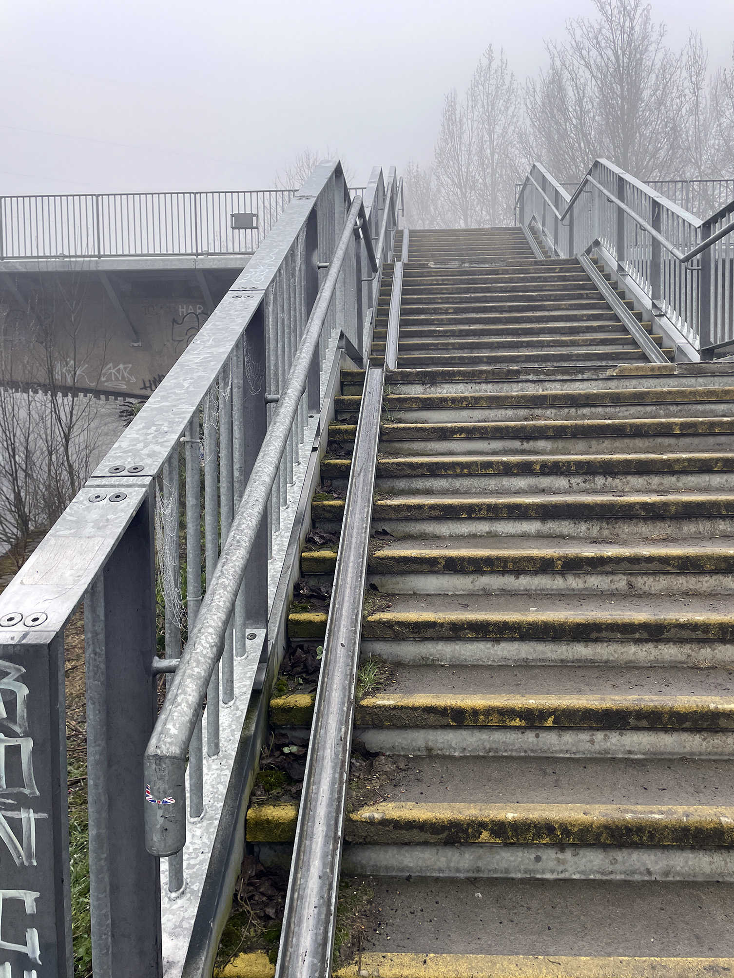
The first leg began on my commute route and followed the Leeds & Liverpool Canal towpath into the city centre, then continued on a cycle path along the river Aire. My Garmin had its usual fit early on when I had only got as far as Leeds Royal Armouries museum, but I put thoughts of returning home to the back of my mind and managed to get it going again. This was entirely expected so I was also using the OS maps app on my phone to record the route and could use it to navigate if needed. Last time I came this way a set of steps and roadworks marked the end of my short ride, but now that bit was passable, only to be met with another set of steps after crossing the river. A pair of lights, or some giant’s eyes, peered out of the mist at a waste facility ahead. The track to wheel bikes down was awful (yes this is an official cycle route), being so steep that even a lightly loaded two-wheeler was a handful to control.
Obstacles cleared, I continued along either the river or Aire & Calder navigation over a variety of surfaces before making my way through St Aidan’s nature reserve, and eventually appearing in Allerton Bywater and a small Tesco. The Costa Coffee machines dispense large volume but fairly weak coffee, which turned out to be just what I needed being quite thirsty, and along with a reduced pack of Welsh cakes I was sustained and ready to continue.
I was now on quiet roads through small villages, still following the river, although it was out of sight in the combination of mist and flat fields, with built-up banks being the only hint of its existence. The thick mist continued so I was rather damp. I tend to wear clear safety glasses when riding as I find my eyes get irritated on long rides (and they keep nature out), but it took me a while to realise that the reason I couldn’t see that well was that they were collecting water droplets and needed frequent wiping. Electricity pylons loomed out of and retreated back into the ground level clouds as I passed.
Snaith marked the half way point and also had a cafe. I checked the time against my plan and realised I didn’t have a lot to spare, having not really thought how slow the first off-road 25 km would be. Even on hard surfaces, the cycle paths are never fast. I also managed to arrive at a peak moment in the cafe and ordering was slow, although delivery of beans on toast was quick. On leaving I thought it was time to start making an effort to go faster where the road allowed.
To Airmyn, and some roads familiar from the Spurn Head, and over the Ouse at Boothferry Bridge just after the Aire has joined it. After following the road to Barmby I had naively planned to follow the cycle path for a couple of kms along the Ouse to Hemingbrough. After crossing a tidal barrage this turned out to be a grass track (I had to double check I was going the right way, it looked so unlikely), then a mixture of single track along which my rear wheel fishtailed, and a muddy section I had to walk through. A lesson in just because you may cycle, doesn’t mean you should.
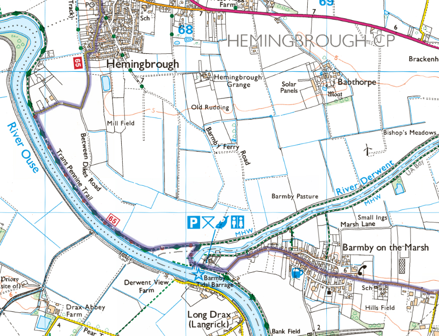
This is very close to Drax power station, but with the mist stubbornly remaining there was no sight of anything. The surfaced road into Hemingbrough was a very welcome sight, and I had a short stop for a can of Irn Bru from the village shop and the remaining Welsh cakes, and commiserated with someone on an e-mountain bike going in the opposite direction about the state of the track I’d just come through, and which he had decided to avoid and was looking for another route to his destination. Finally I felt it was safe to shed the wind shirt here; balancing warmth and dampness had been a bit of a challenge all day.
The final section took me to Selby, and shortly further north on to the planetary route into the centre of York. I have been on short sections of this before but this was the full way in from Riccall. Still mindfull of time I pushed on with a respectable speed which was happily achievable even though it’s a shared cycle/pedestrian trail.
Disgorged onto a main road in York but still on a cycleway I had to negotiate a steep twisty climb up to road level (cramp!), and a complicated route around a roundabout, but soon arrived at the Delta hotel where the reunion was being held. The sun was now out! I had made it within the time limit, and was very pleased to see none other than Peter (one of the reunion organisers) on the welcome desk just inside the hotel entrance. There was a room for bike storage, and I had time to grab an audax sandwich (cheese savoury from the petrol station opposite) before the afternoon’s talks began. Later a very easy ride straight up the road, past the Crescent, left for the station, and a train home.
OS maps: 109 km, 240 m climbed, 6 hrs 22 mins; or Garmin: 105 km, 193 m climbed, 6 hrs 20 mins